I struggled to pack my 5 kg for the trek. The erratic scales at the hotel and my hire sleeping bag weighing in at 2kg didn’t help!
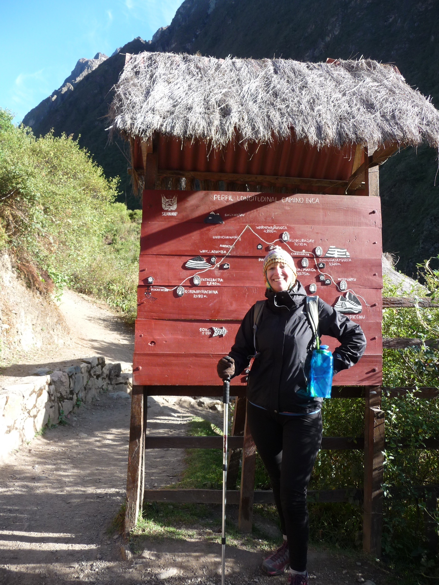
We had an early start from the hotel with our guide and some of our porters. The first stop was Ollantaytambo where our bags were weighed again (the authorities allow the porters to carry up to 25 kgs each) and we passed through the 82 km checkpoint (the distance being that from Cusco along the train track). Only 500 people are allowed on the trail per day (including trekkers and all tour operator staff) so it is a rigorous checking of identities before being let loose to trek.
There are more than 25 000 kms of inca trails in Peru – ours being the most famed for linking Machu Picchu with the Sacred Valley.
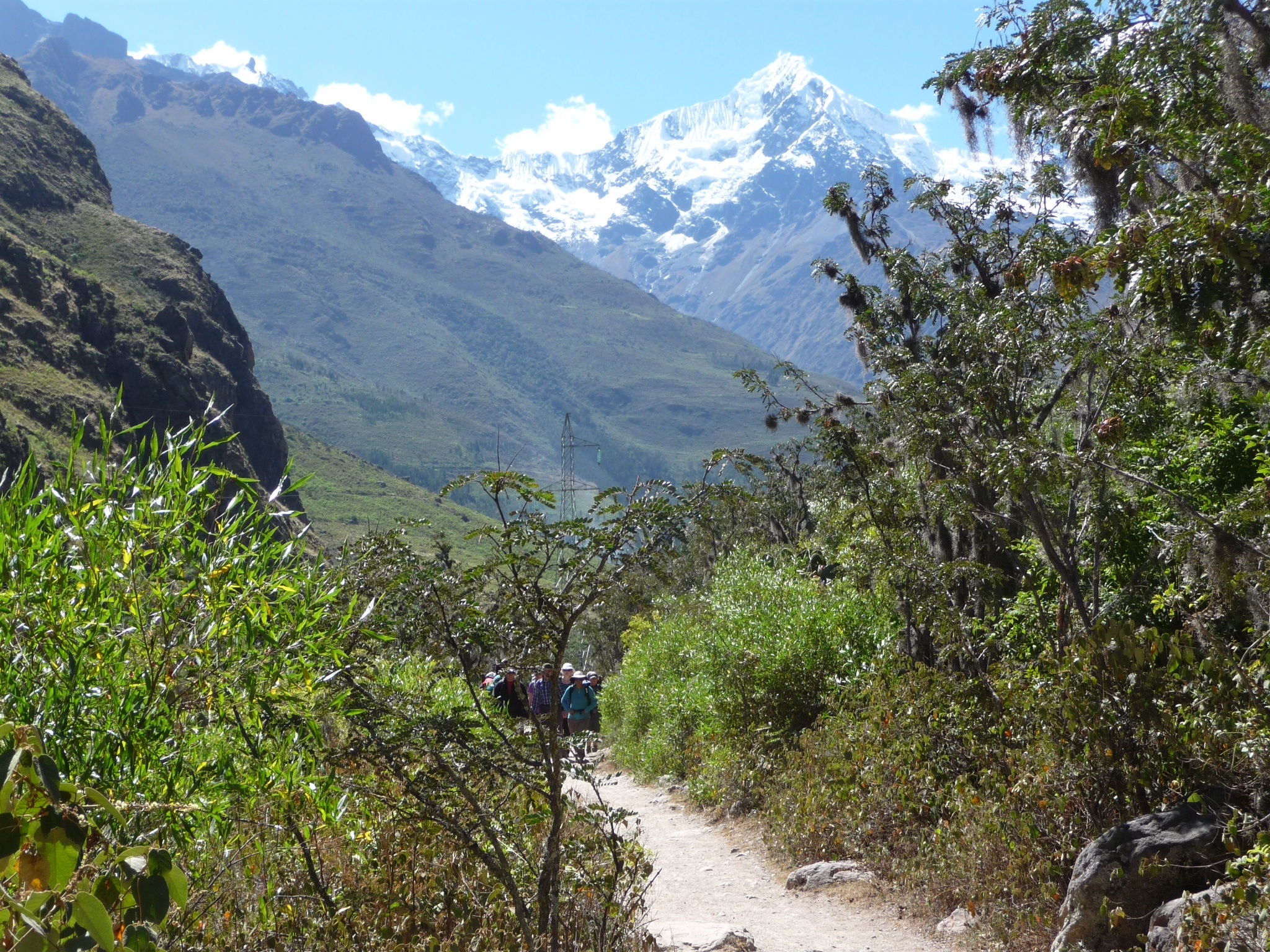
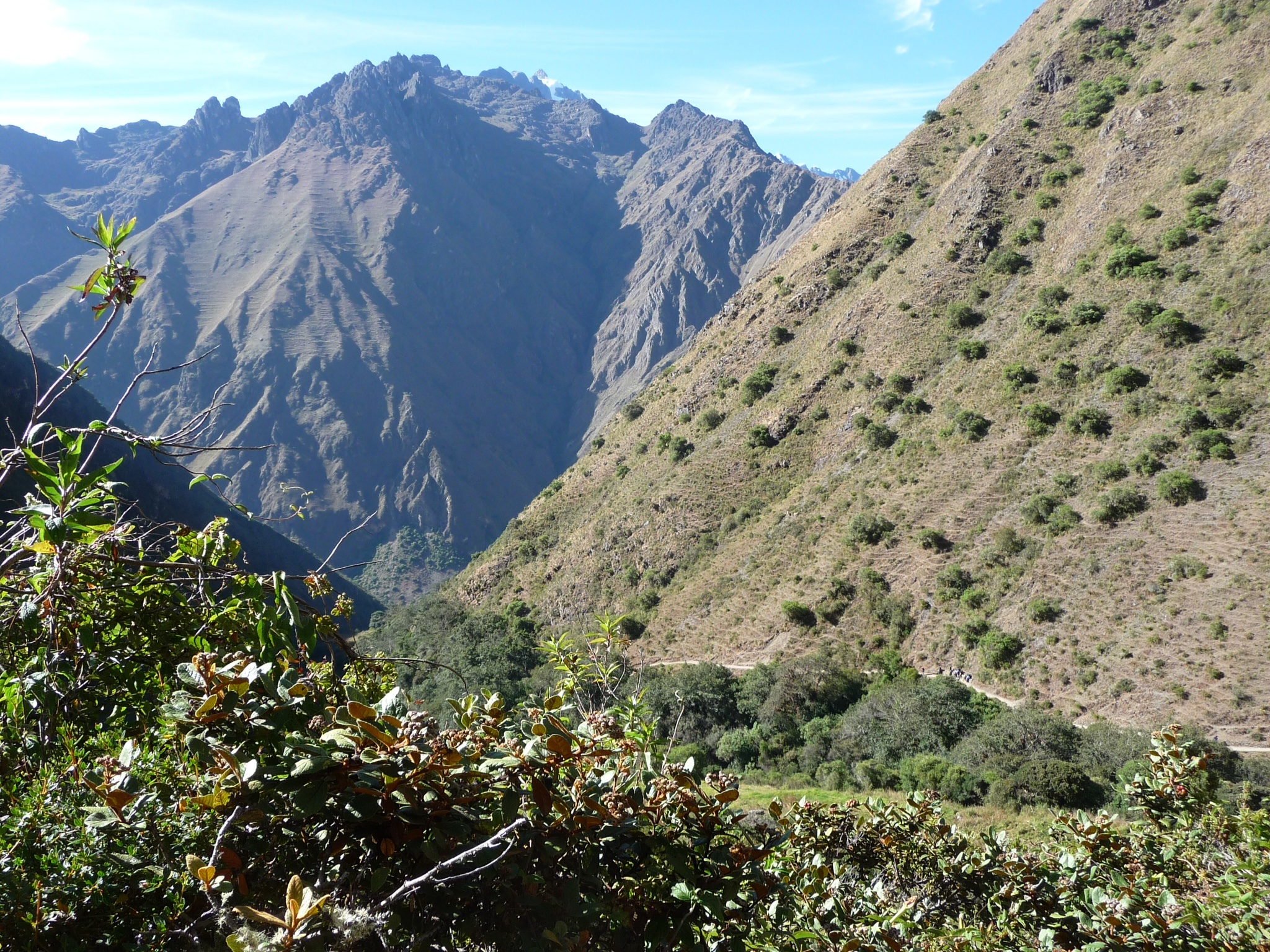
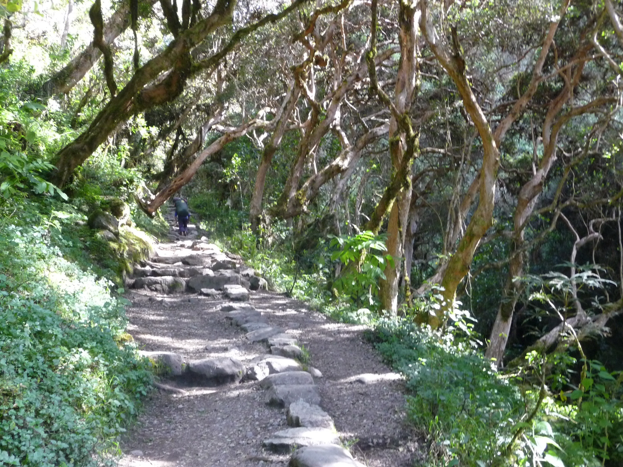
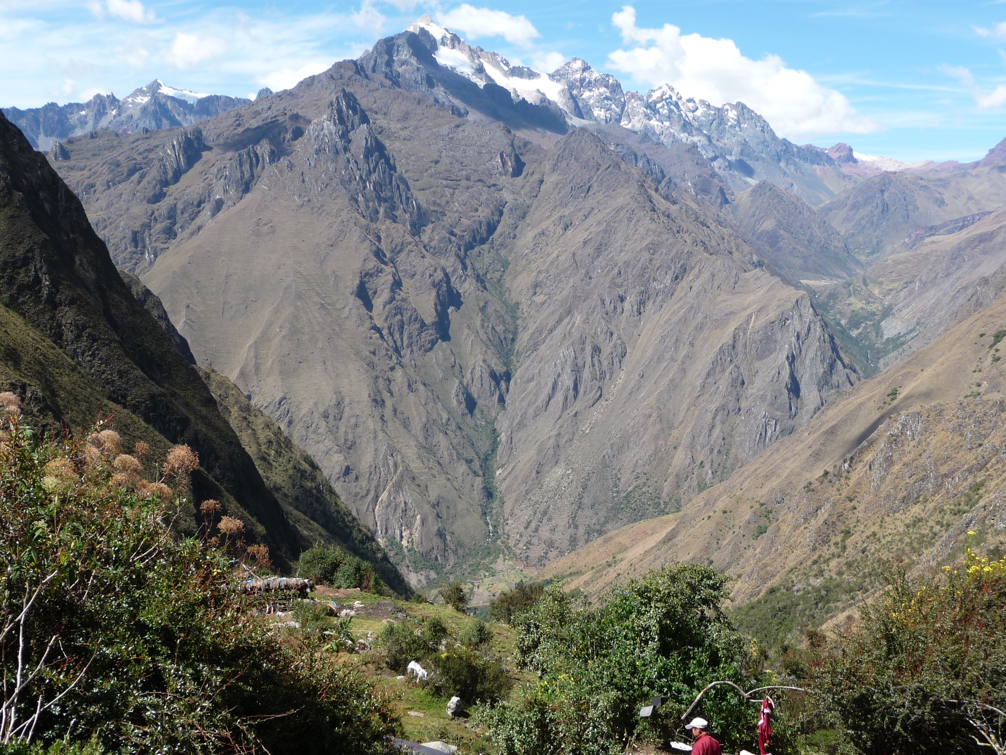
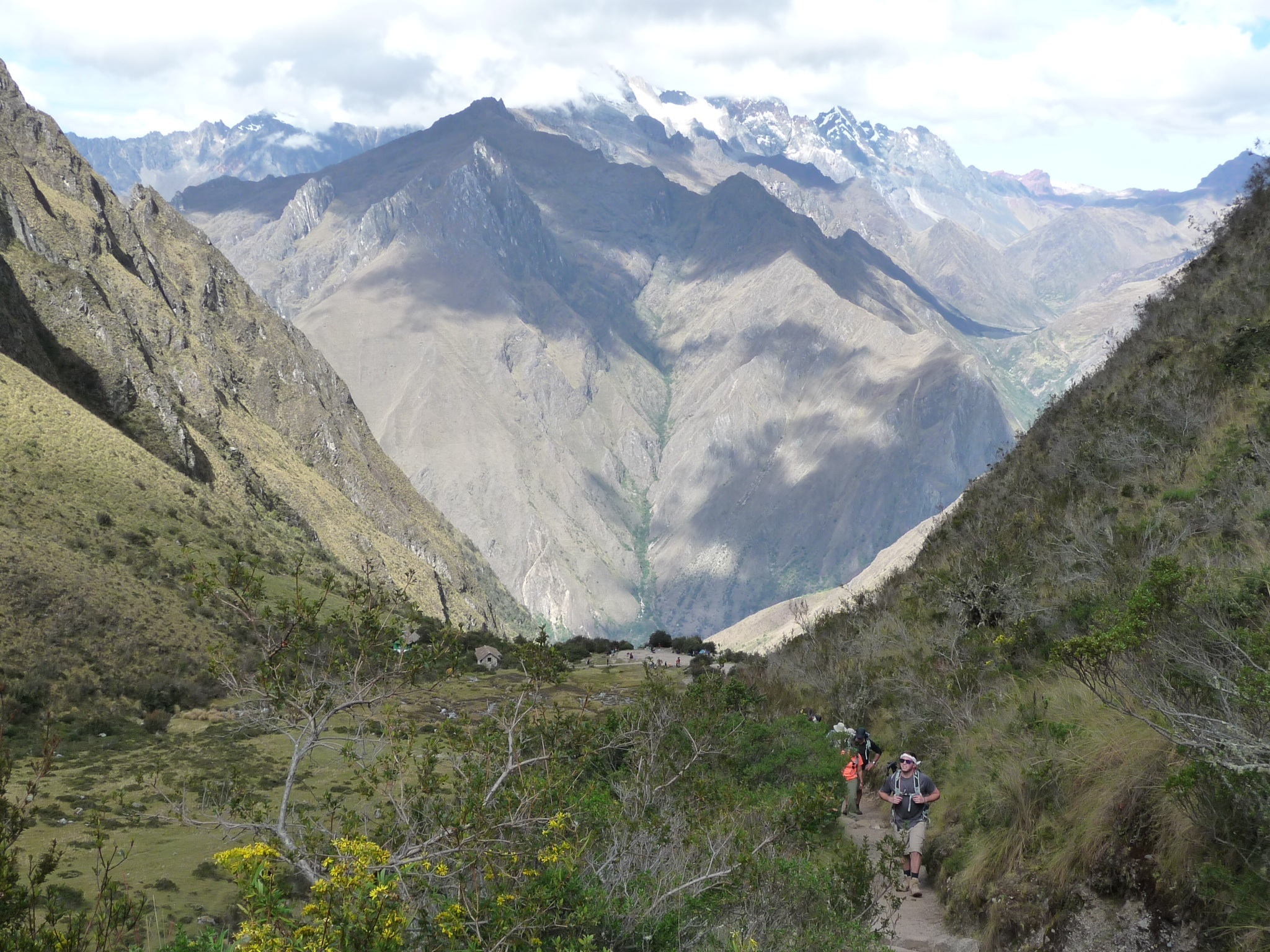
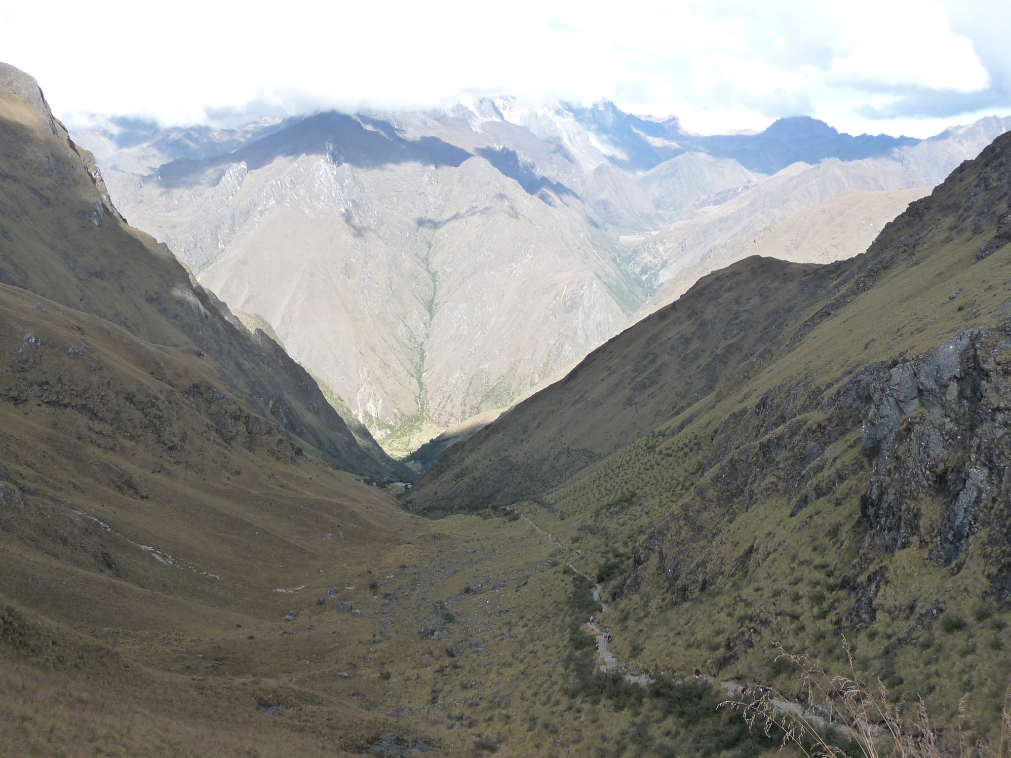
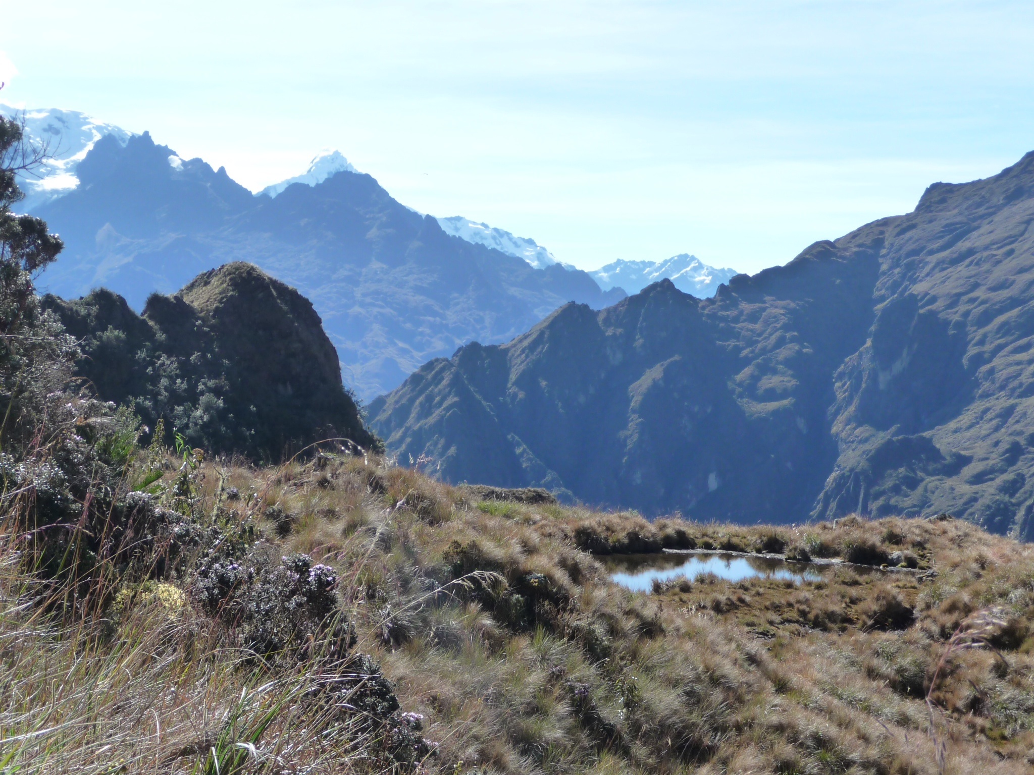
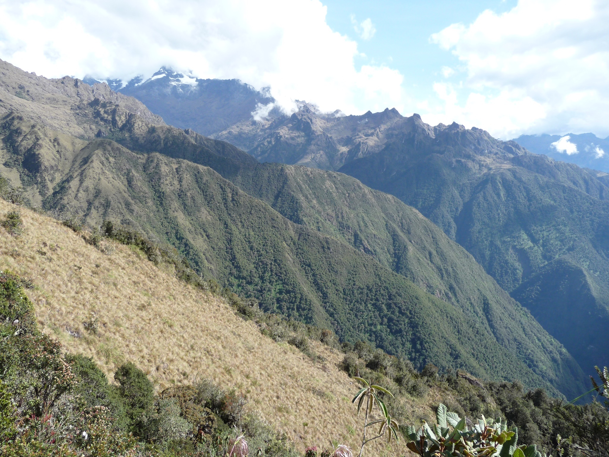
We headed out for our first day of 12 kms with the impressive 5700m glacier laiden Veronica mountain behind us.
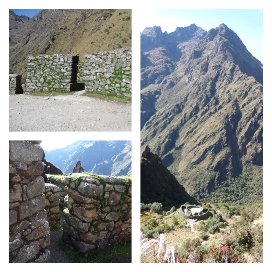
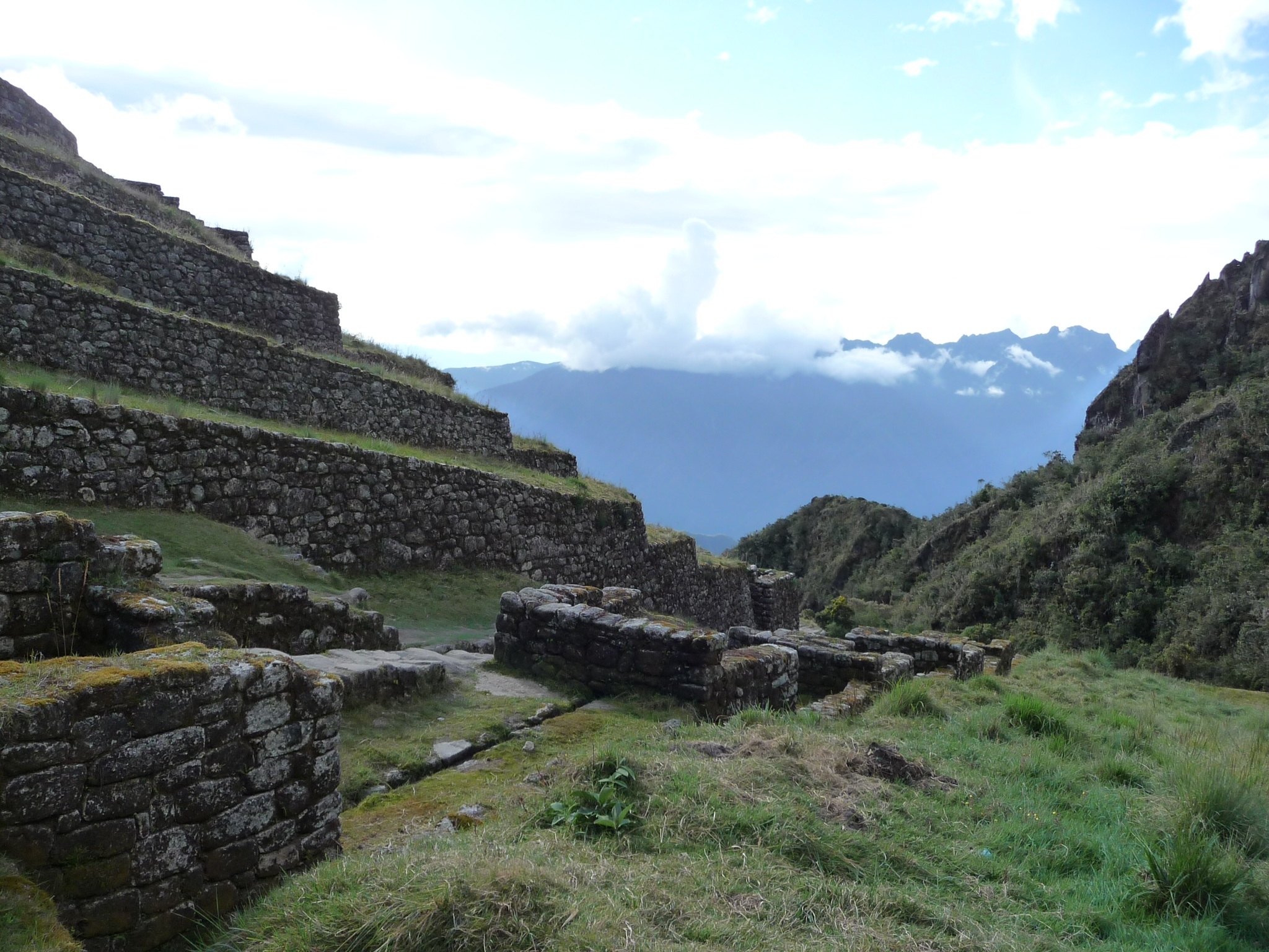
The beginning of the trail was relatively kind with us stopping at inca ruins along the way – the first being the inca village of Qhanabamba.
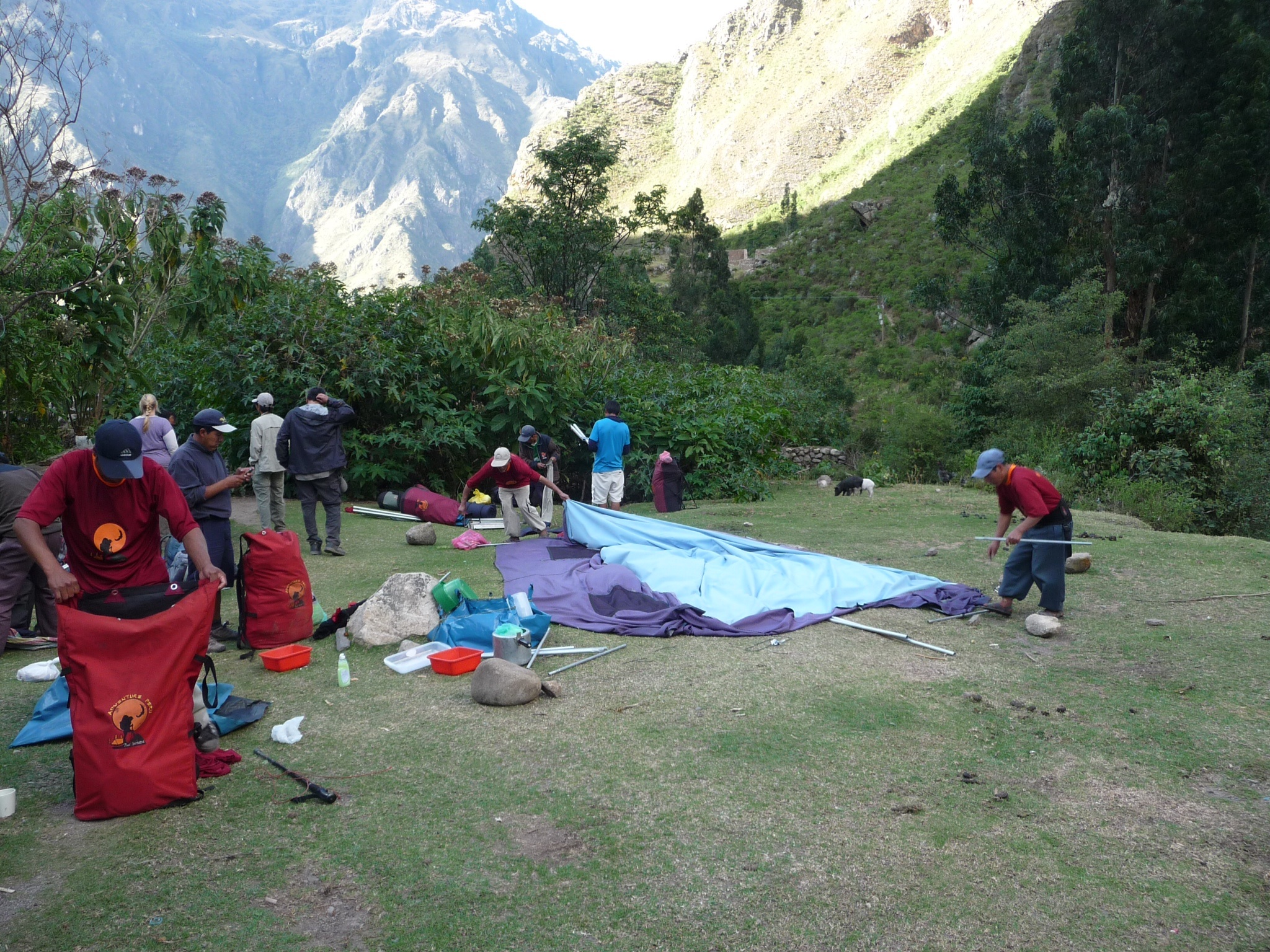
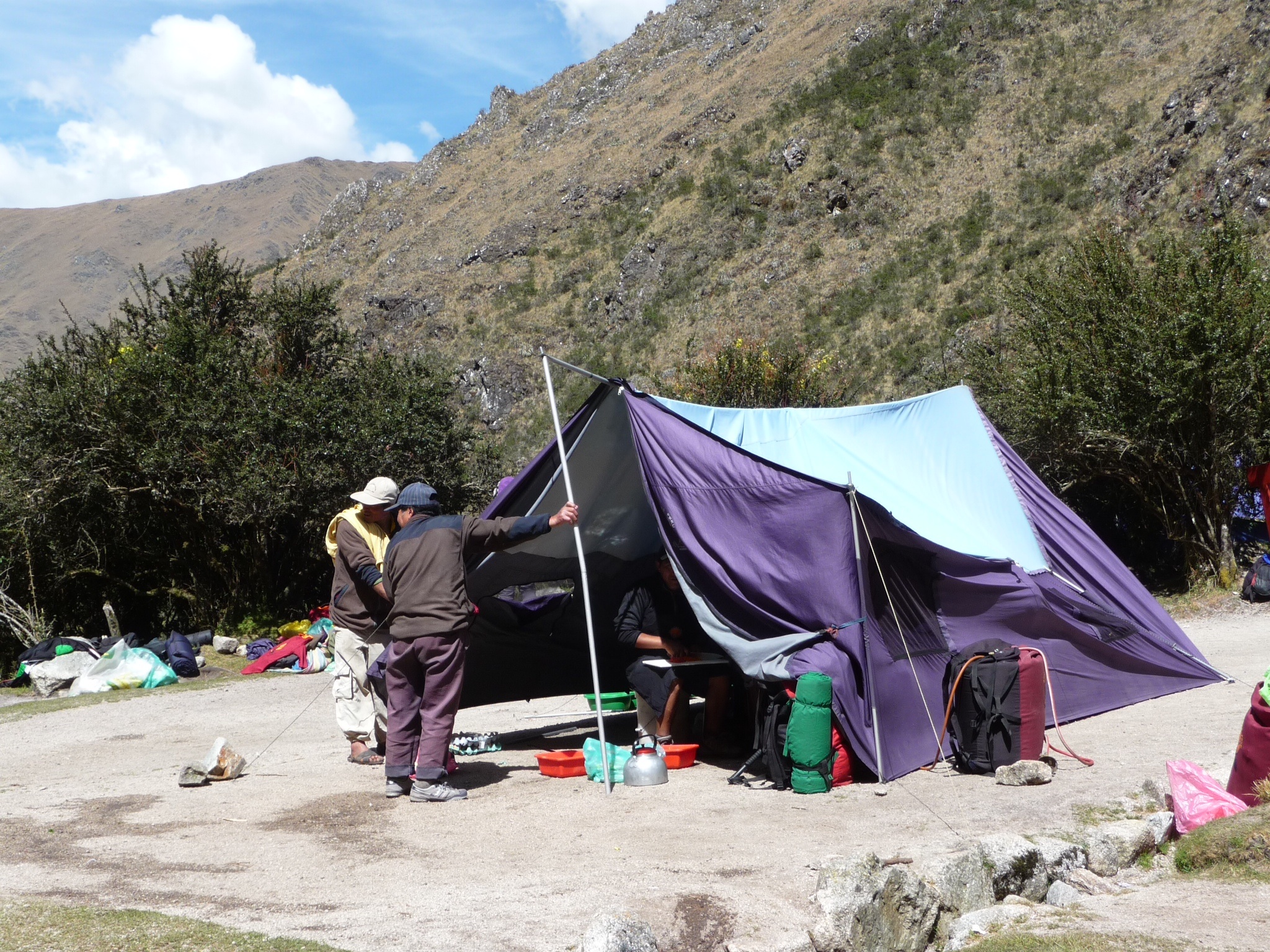
We then started to get a taster of what was in store for tomorrow with some ‘Peruvial gradual’ – it was up, up, up! We were all pleased to reach the lunch stop to find our porters had set up a camp kitchen and tent for dining. We had a delicious Peruvian two course meal full of carbs – lupin beans and potatoes.
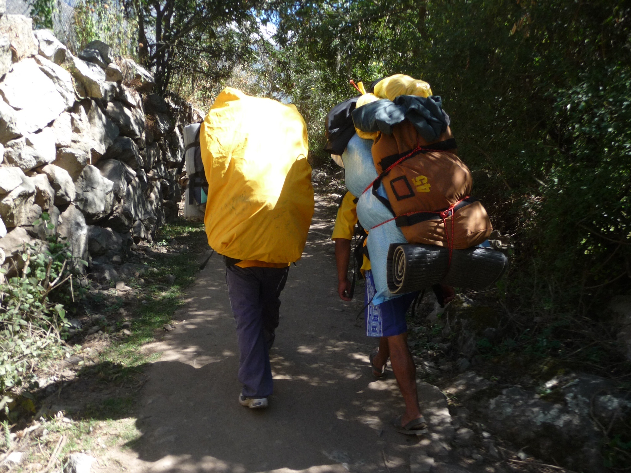
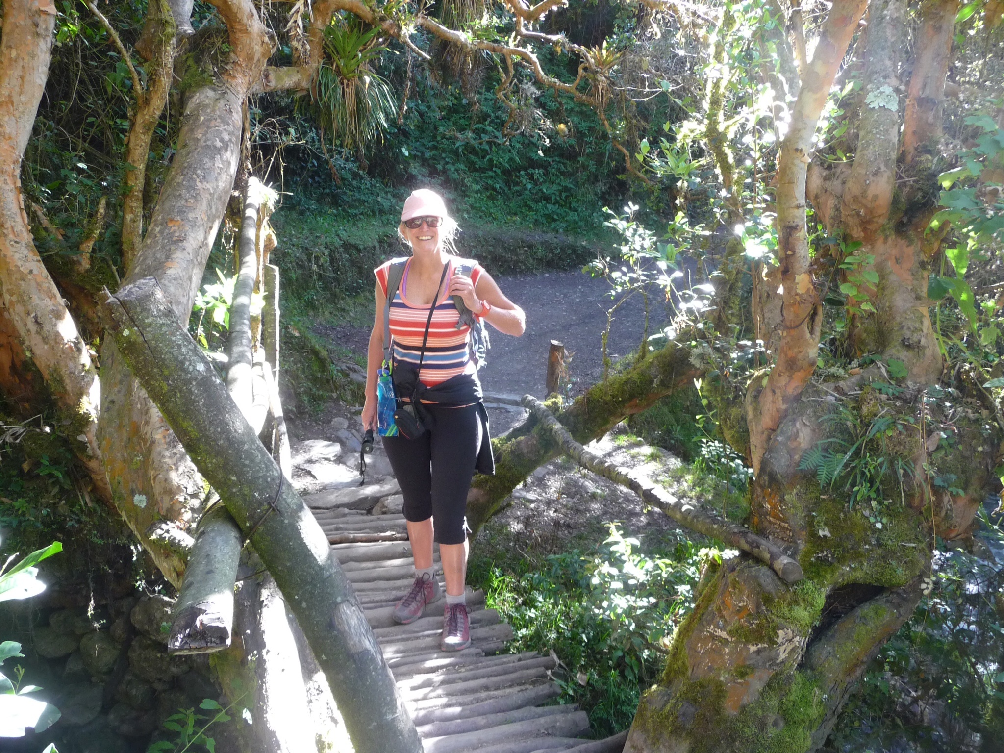
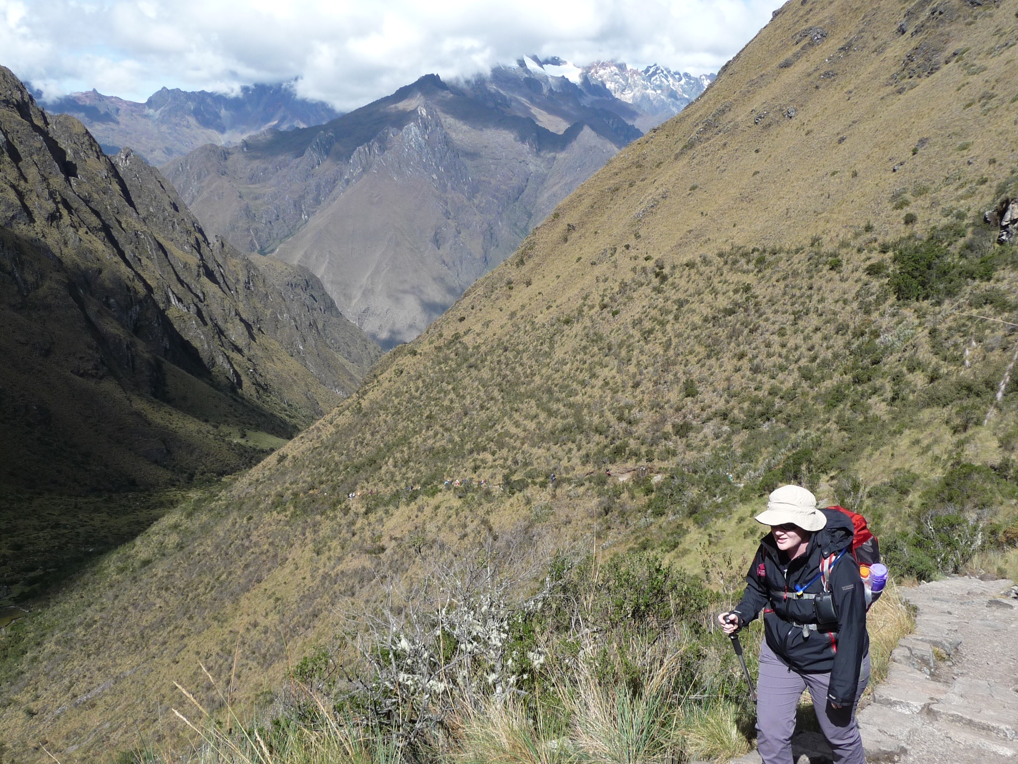
We set off leaving our porters with the job of packing everything up and transporting it to the campsite ahead of us. They all passed us on the way putting us to shame – them with their packs of 25kgs strapped to their backs (tents, cooking facilities, food, chairs, our duffle bags, etc) and us with our piddly day packs toting some water and snacks! Most were wearing a type of roman sandal (something for the 80s kids) and all of us had hard core hiking boots/shoes.
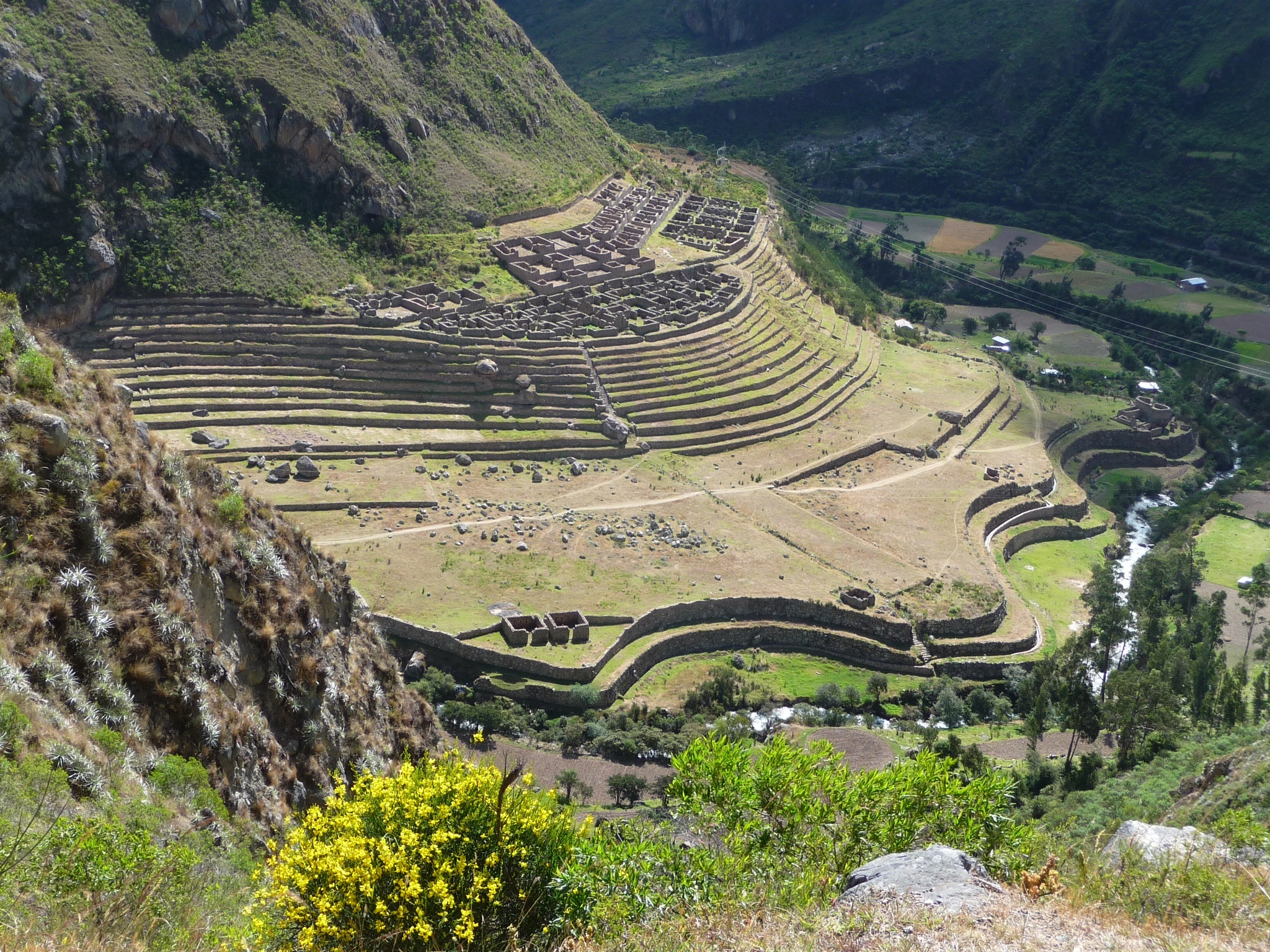
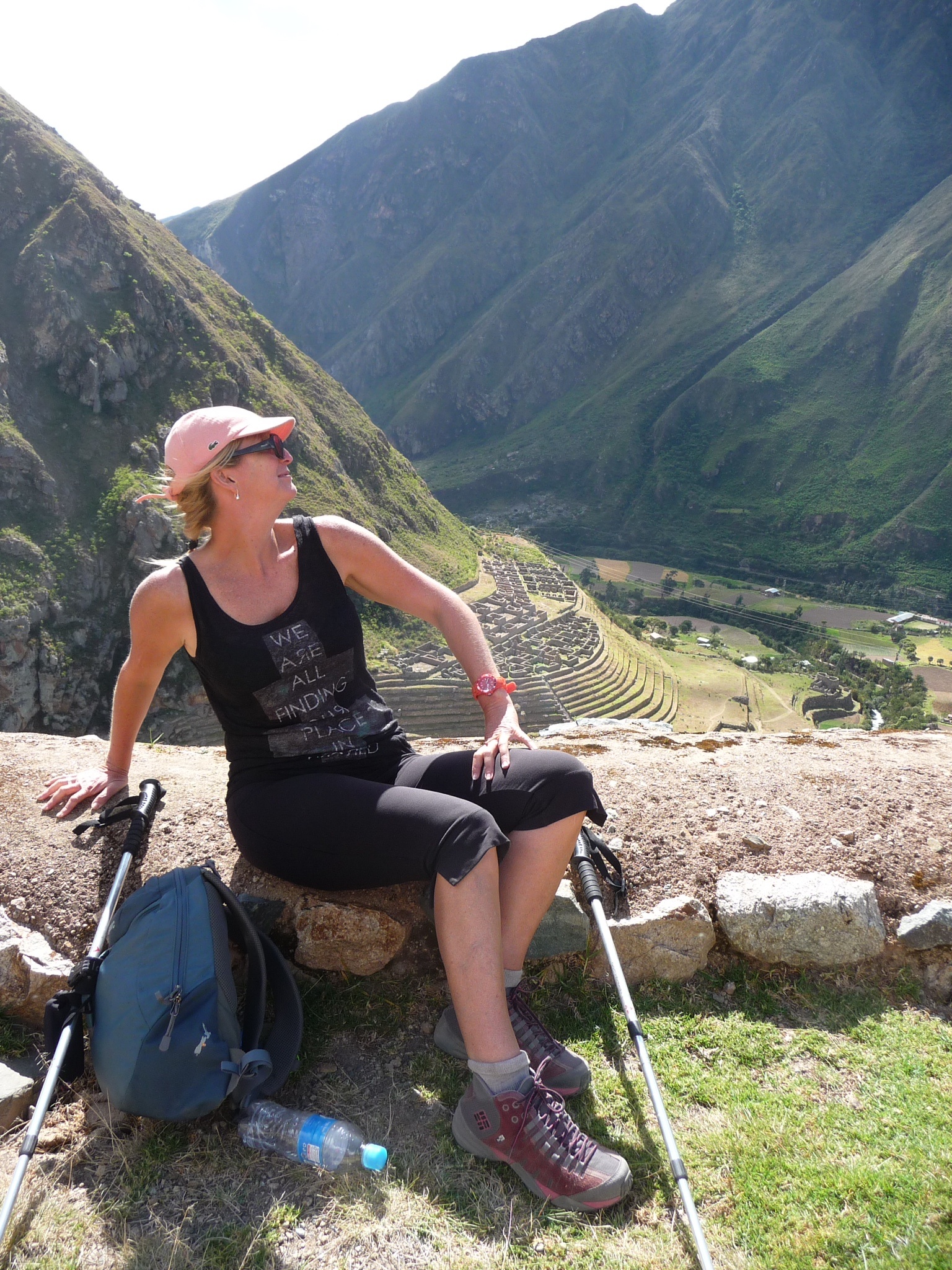
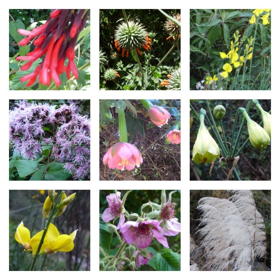
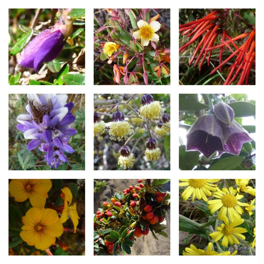
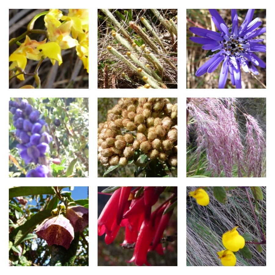
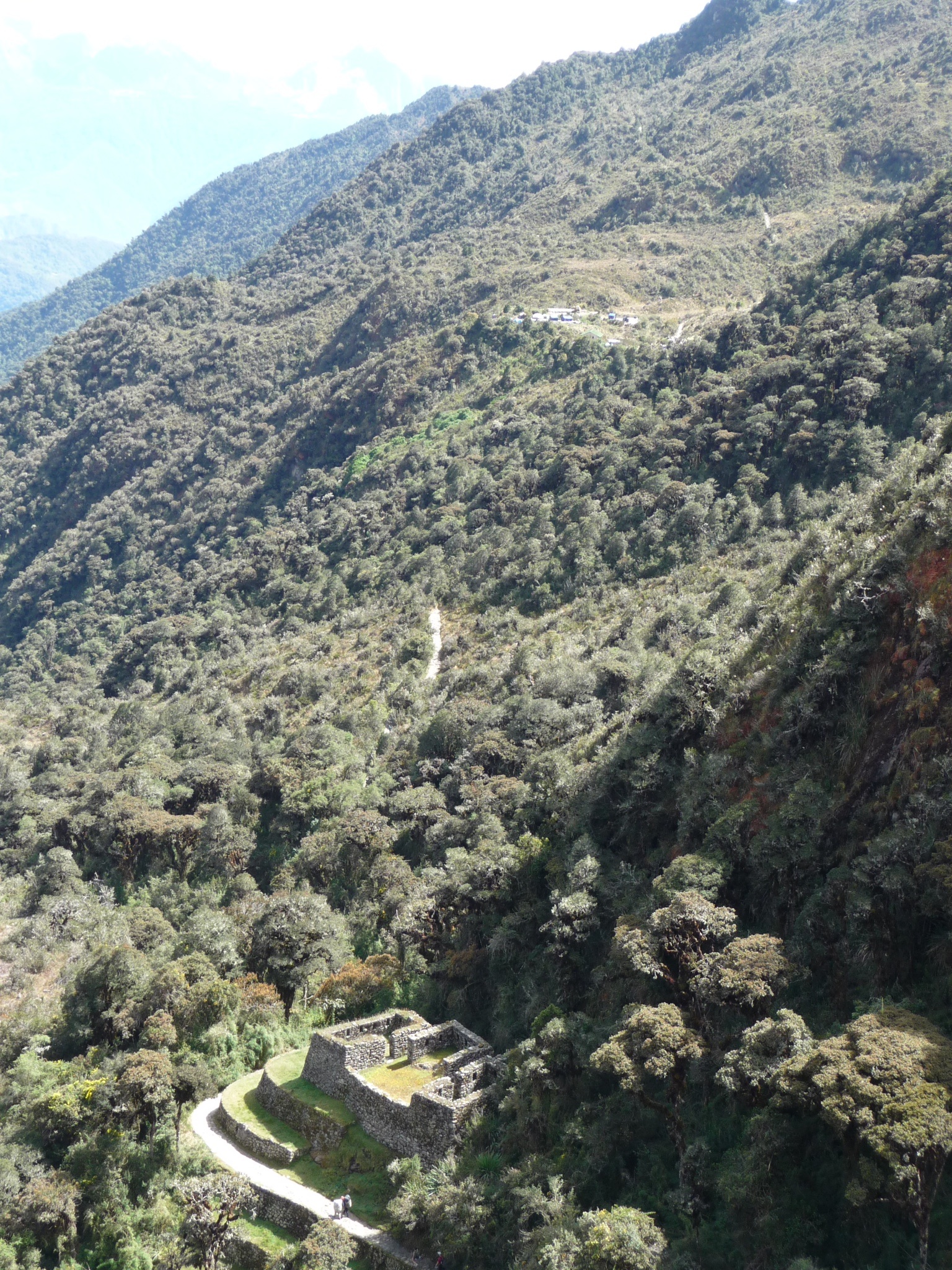
We got another rest as we stopped at another village – Willkarakay, which provided great views of Patallaqta Qentimarka. From then on Megan, my walking buddy, and I found a good way to distract us from the trekking – flower spotting.
On arrival to our camp our tents were already set up and we were each presented with a hand basin of warm water to wash down – a real treat when we had prepared only for wet wipe showers for three nights!
It had been a relatively easy day but I managed to convince most to do some basic stretches knowing that the next day over Dead Woman’s Pass (Abra de warmi wañuska) would be the hardest for the trail. At that point I was thinking I could in fact end up being the dead woman!
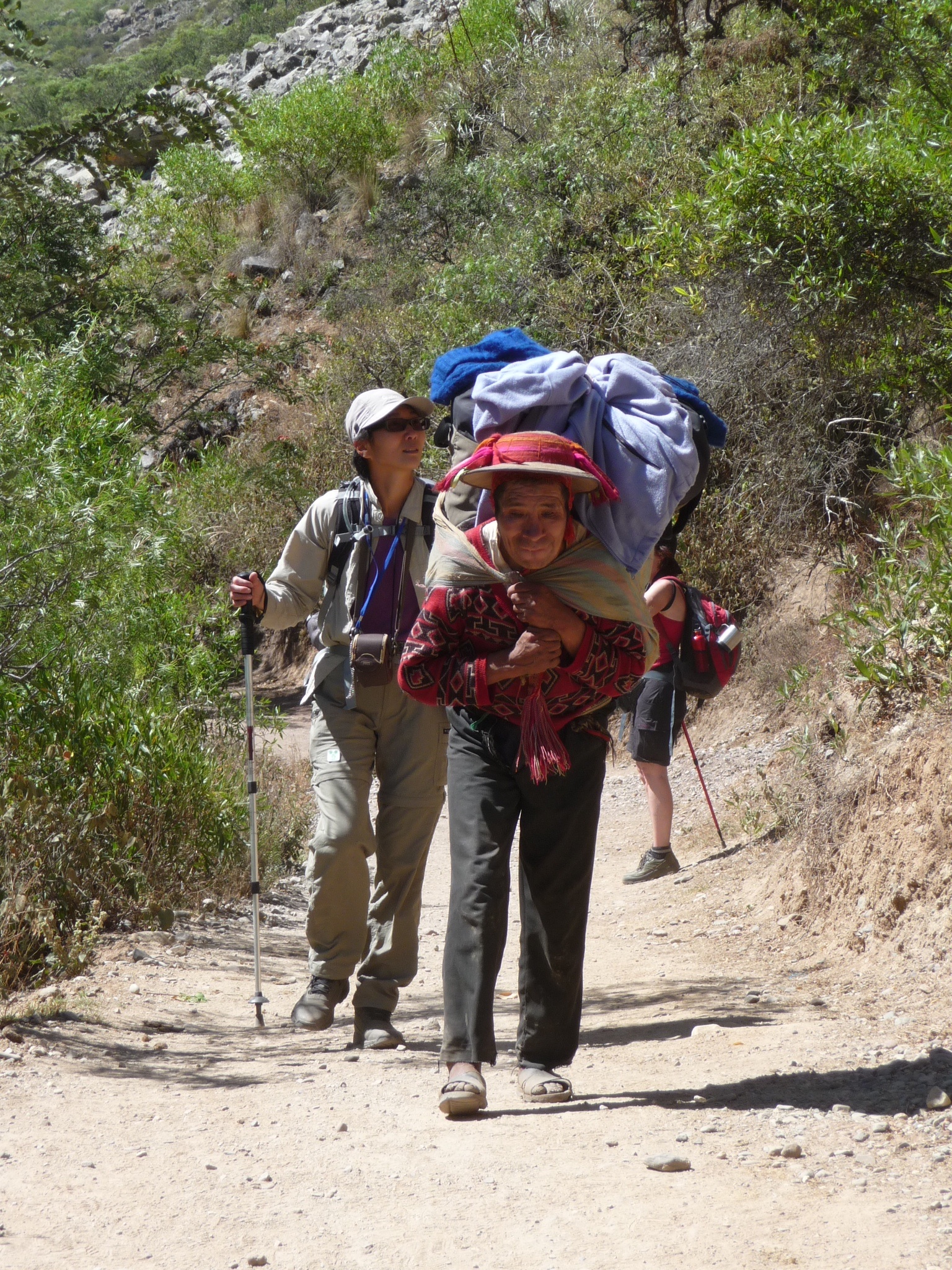
It was an early start for day two (nine kms) with us receiving a wake up call at 5:30am. We had half an hour to pack up, then another half an hour to have breakfast before starting the formal introductions with the most important people on our trek – the cook and porters. They were funny, few speaking English, but all interested in everyone’s vocation and marital status (by translation from our guide, Ruben).
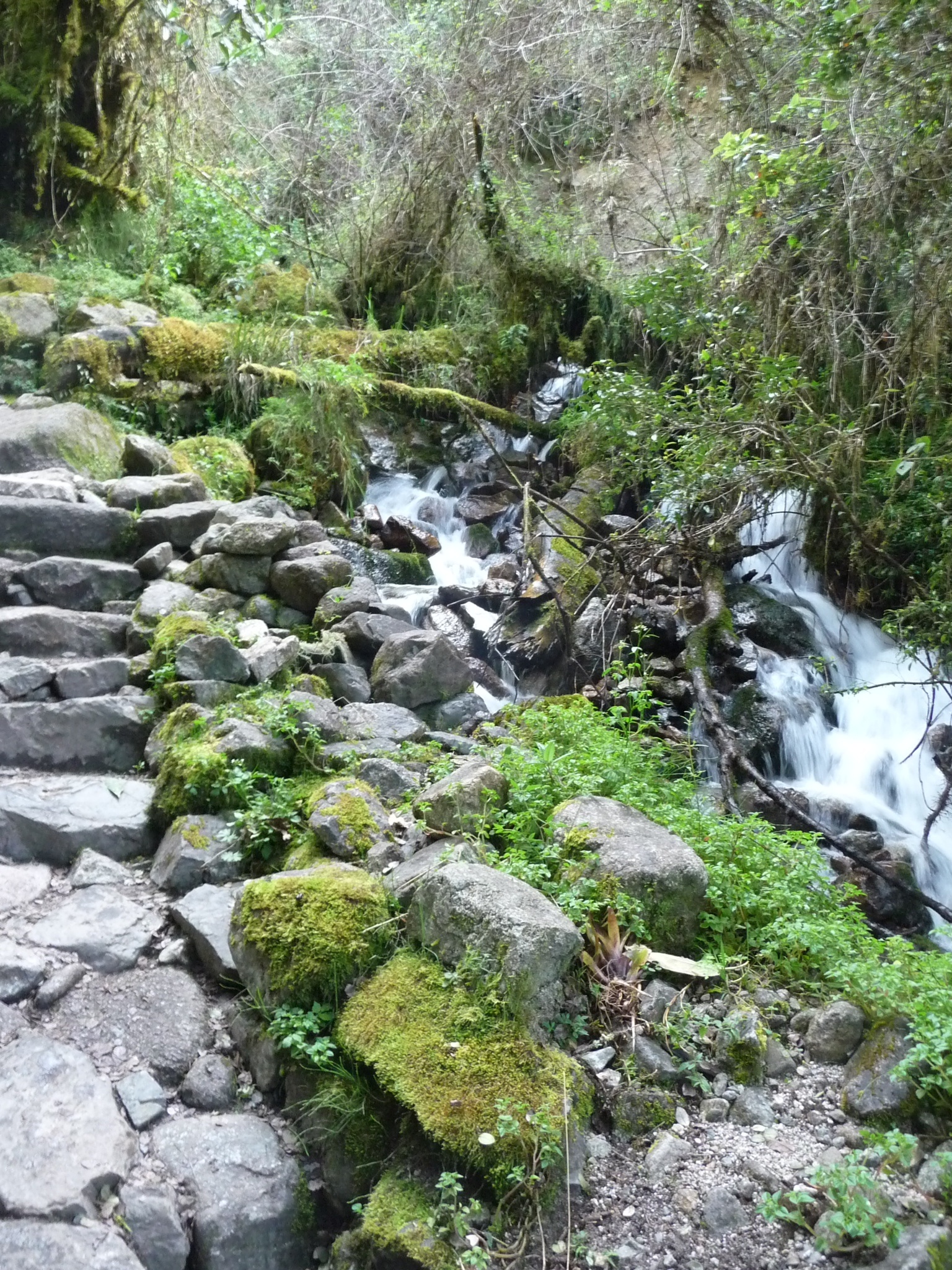
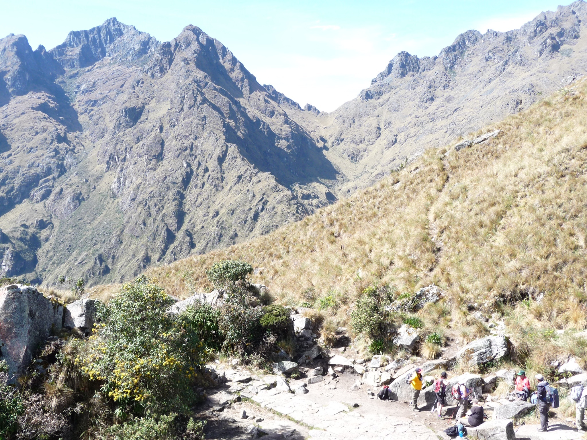
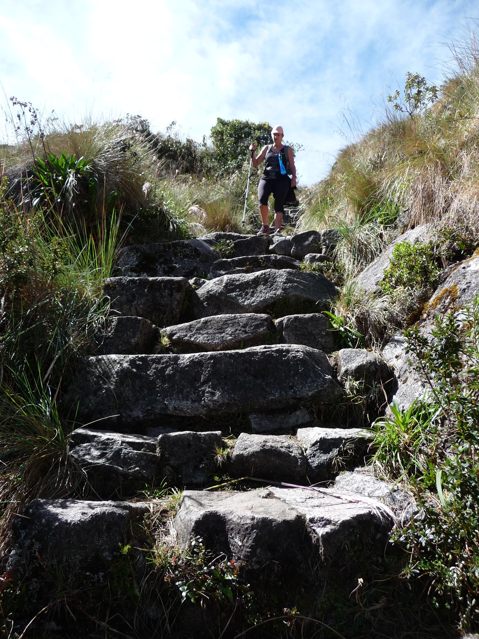
As promised by Ruben, the morning walk just went up, up and up via an endless number of rock steps. The scenery was beautiful and to see the trail ahead and behind full of people was a wonderful sight. Megan and I even managed to spot a deer while stopping in a quiet spot for a break and snack.
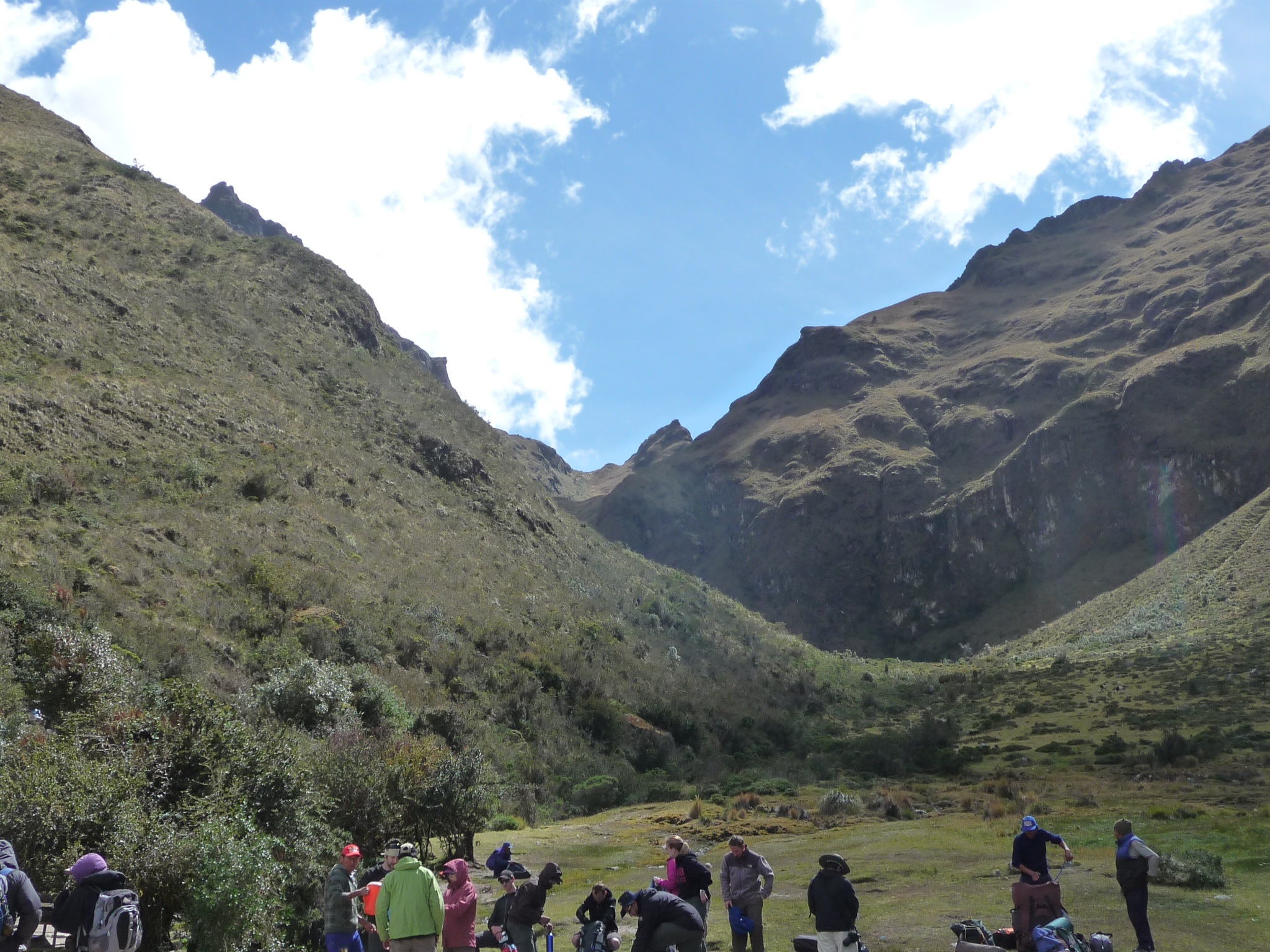
Another great camp lunch, this time perched high above the camp village we had left in the morning. Megan and I were making good progress allowing plenty of time for stretching and a rest before another fabulous lunch. We were then off to trek up to 4200m to the dreaded Dead Woman’s Pass and then downhill by deep steps all the way to the campsite. It was a tough day but the scenery made it all worth it.
Our basins of warm water arrived but this time we confined ourselves to our tent, stripped down and had a decent tub – much to the amusement of the porters. It was so nice to be clean for our dinner celebrating our accomplishments for the day. Then into bed by 8pm out of pure exhaustion.
Another 5:30am rise for our 16km trek. It had been a very cold night and was still very cold without any sun shining into the valley of our campsite. It was a tough start – muscles sore despite the stretching. To make things worse it was up hill first up as we headed toward the second pass. There were more ‘F’ bombs dropped than in the Galápagos but for completely different reasons!
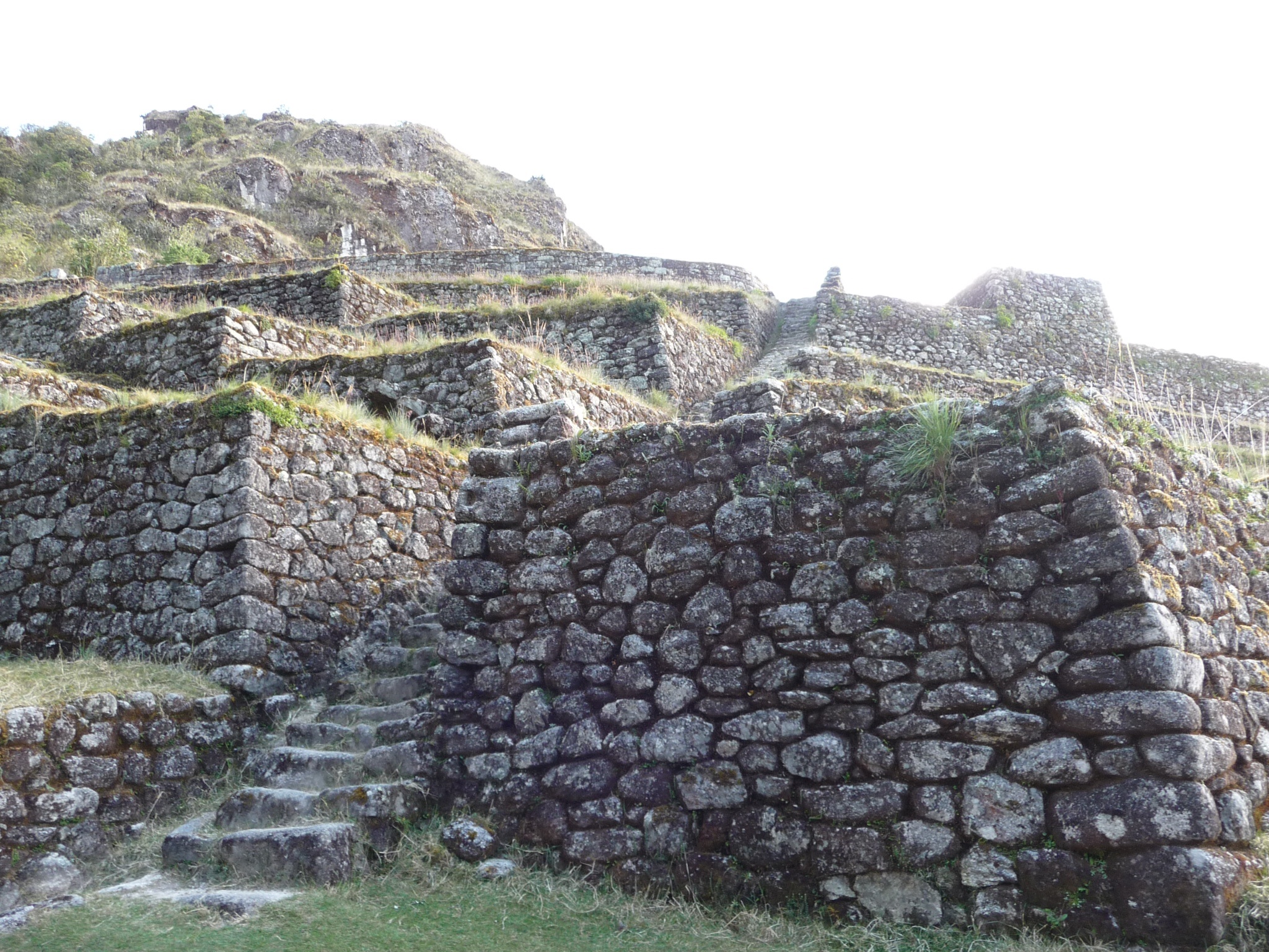
The first ruins for the day were Runkuraqay – a former control point for the incas using the trail.
We arrived at the second pass before lunch; another stop at 4 000m. I still wasn’t feeling the effects of altitude other than the standard breathlessness exacerbated by the trekking – the acclimatisation in the Colca Canyon had obviously worked.
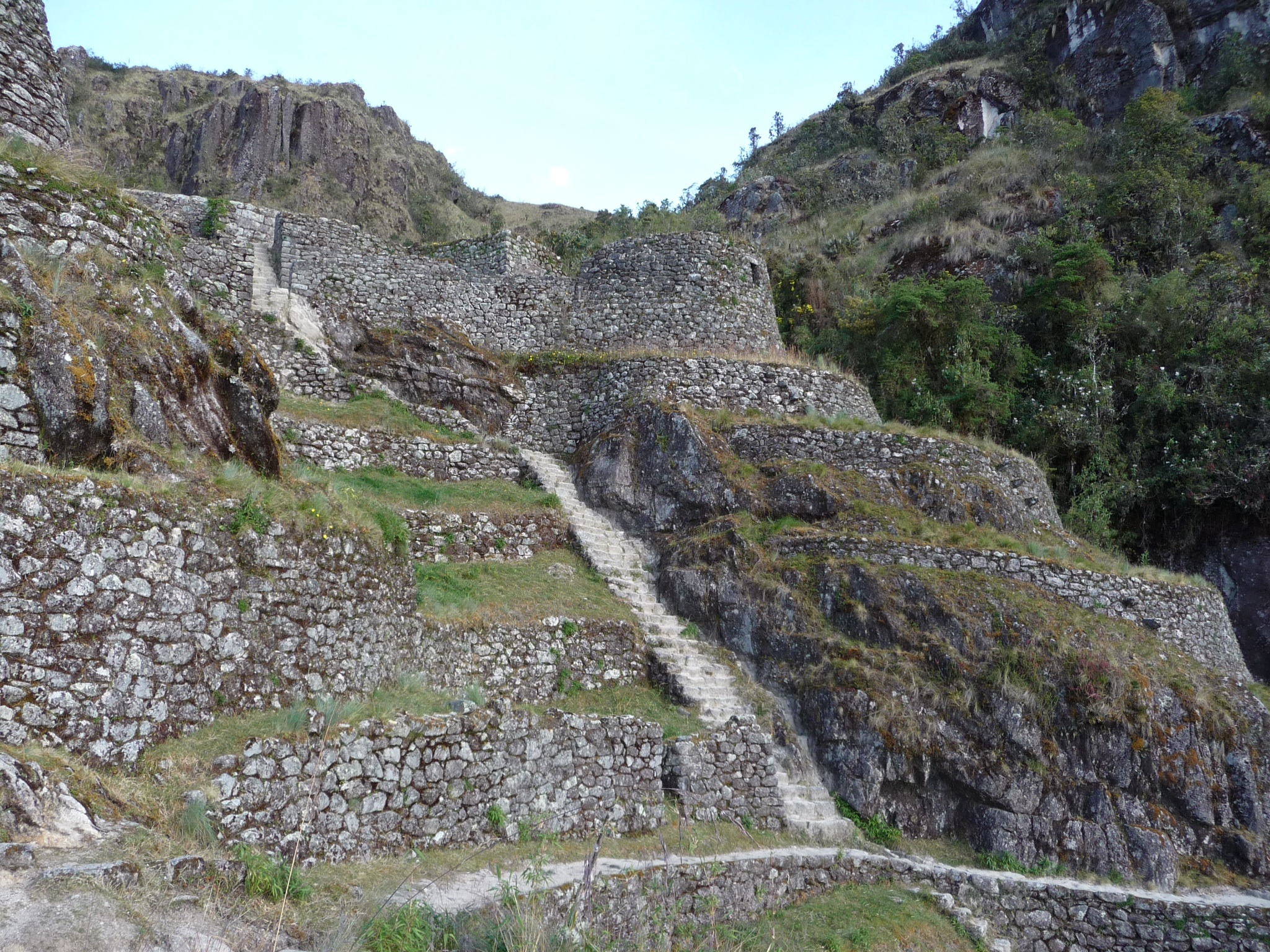
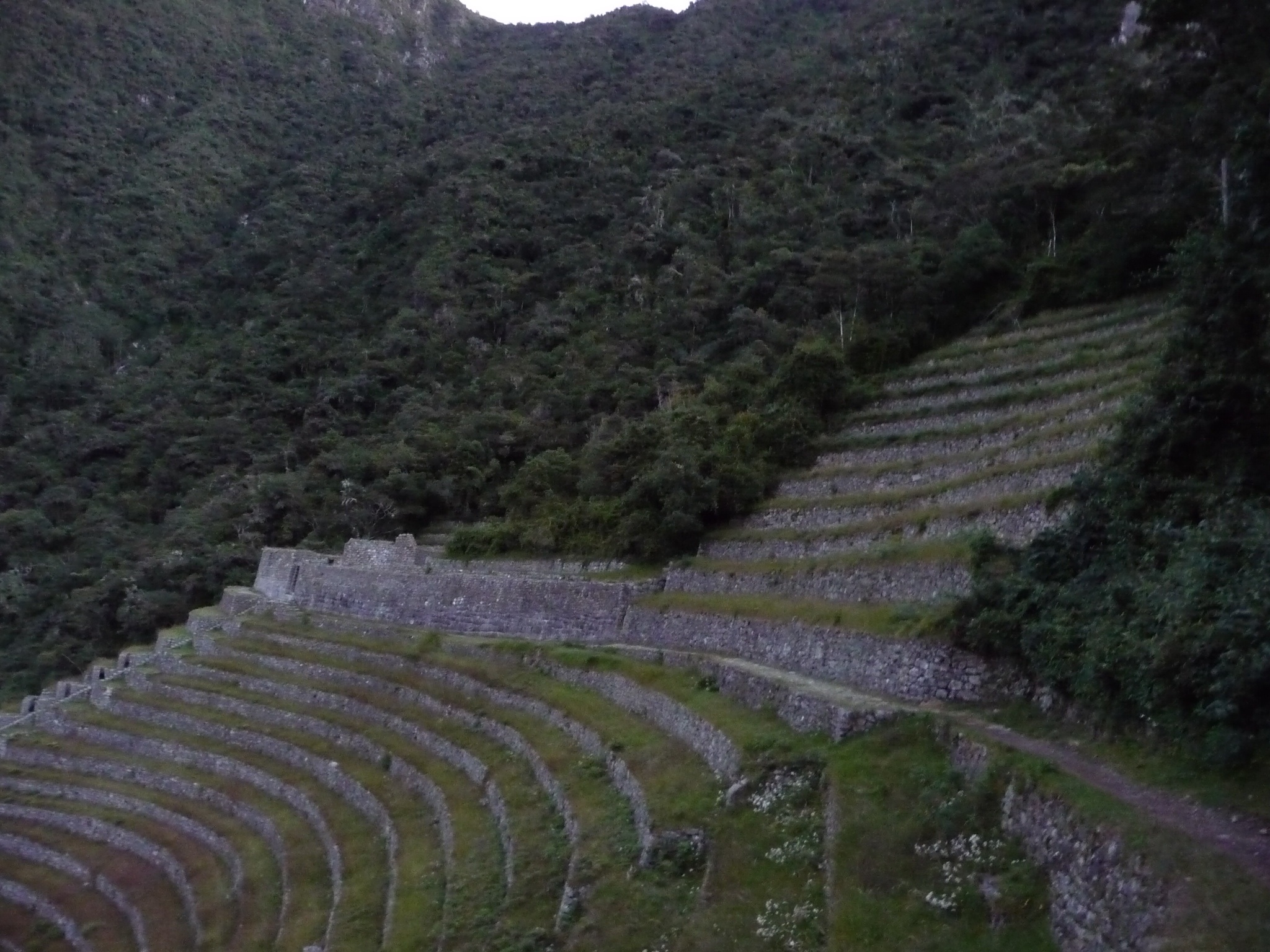
The next ruins were Sayamarka – a rustica style precinct – a likely hostel for incas on the trail to Machu Picchu. Nearby was Qonchamarka; an agricultural site for Sayaqmarka.
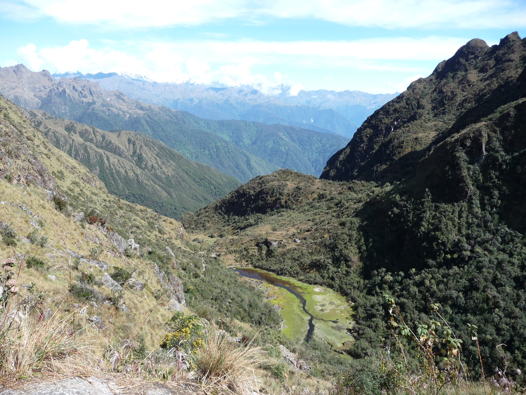
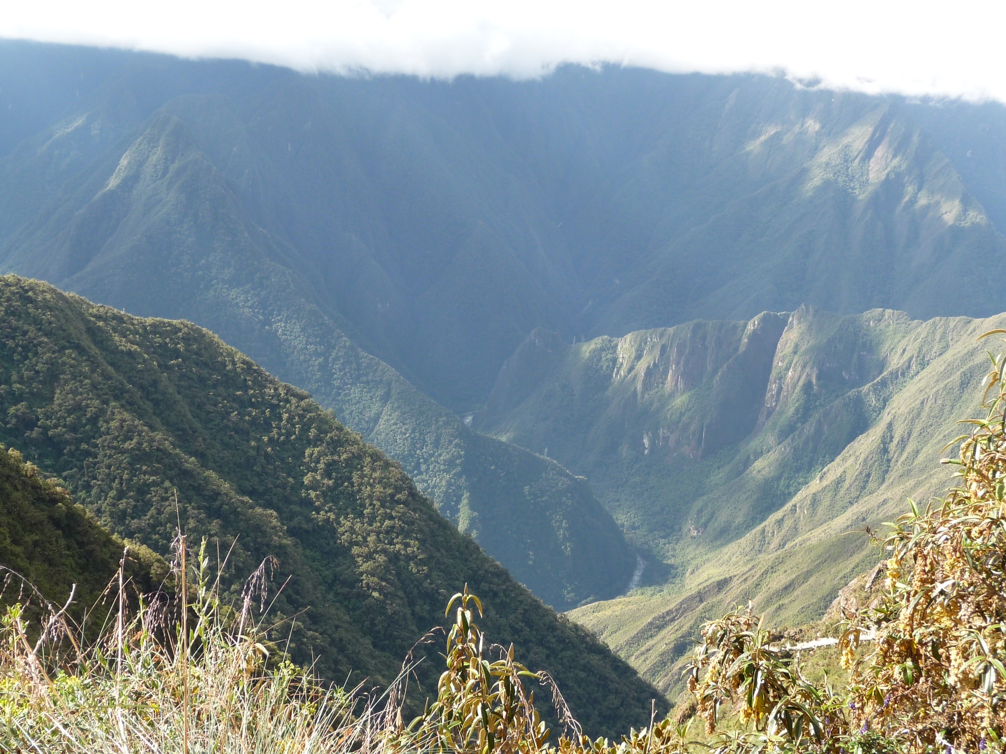
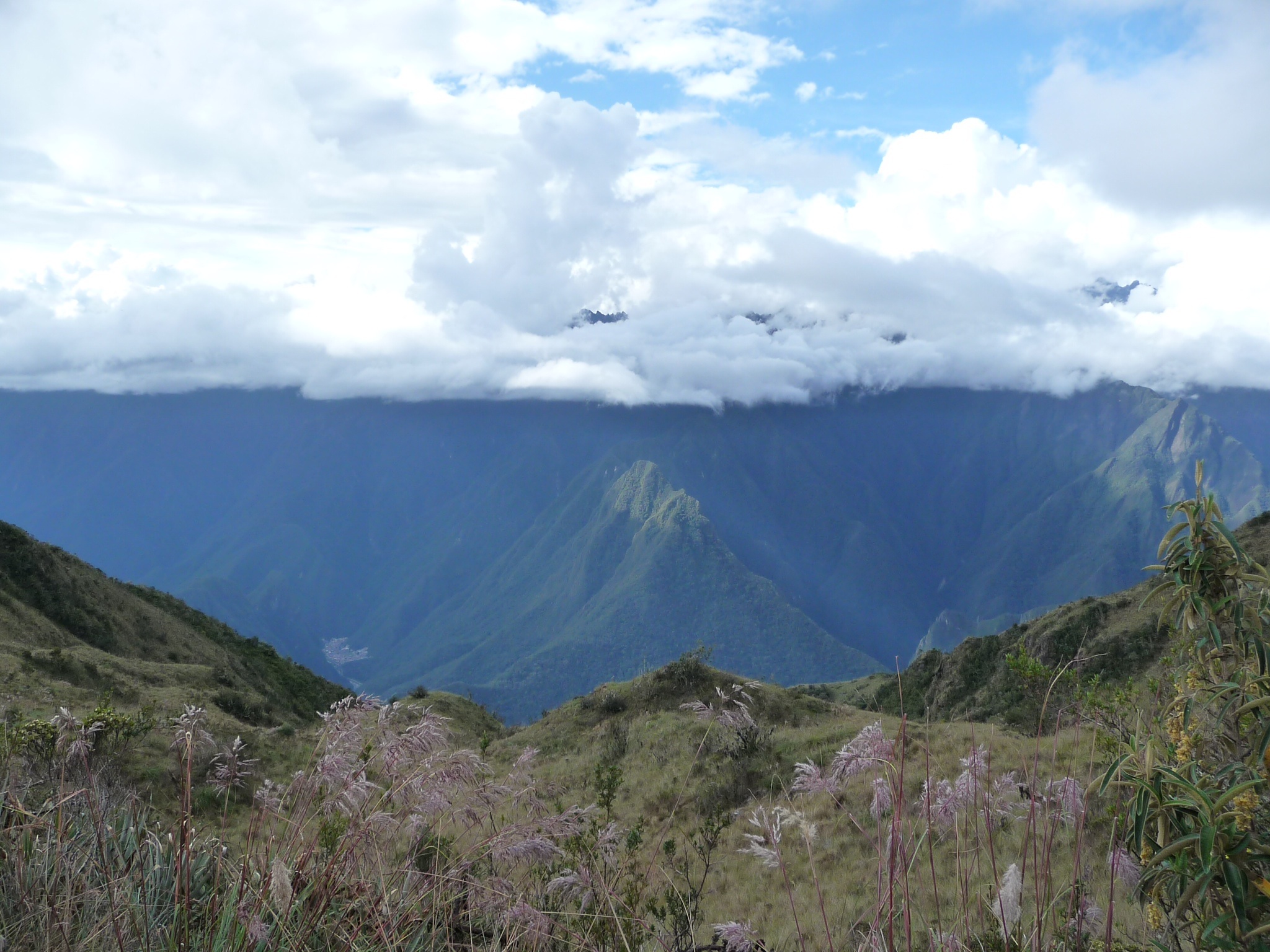
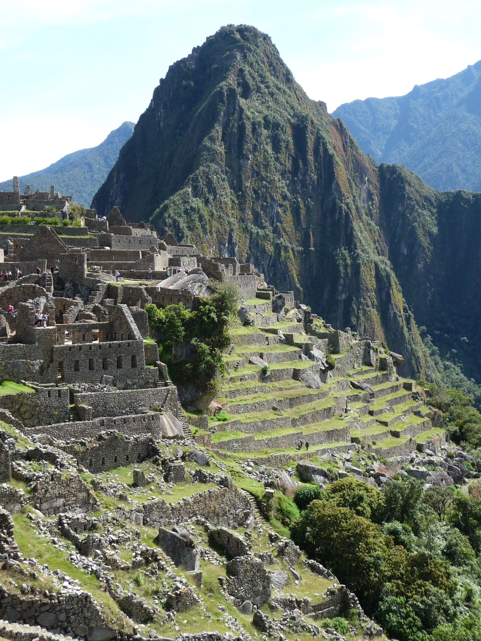
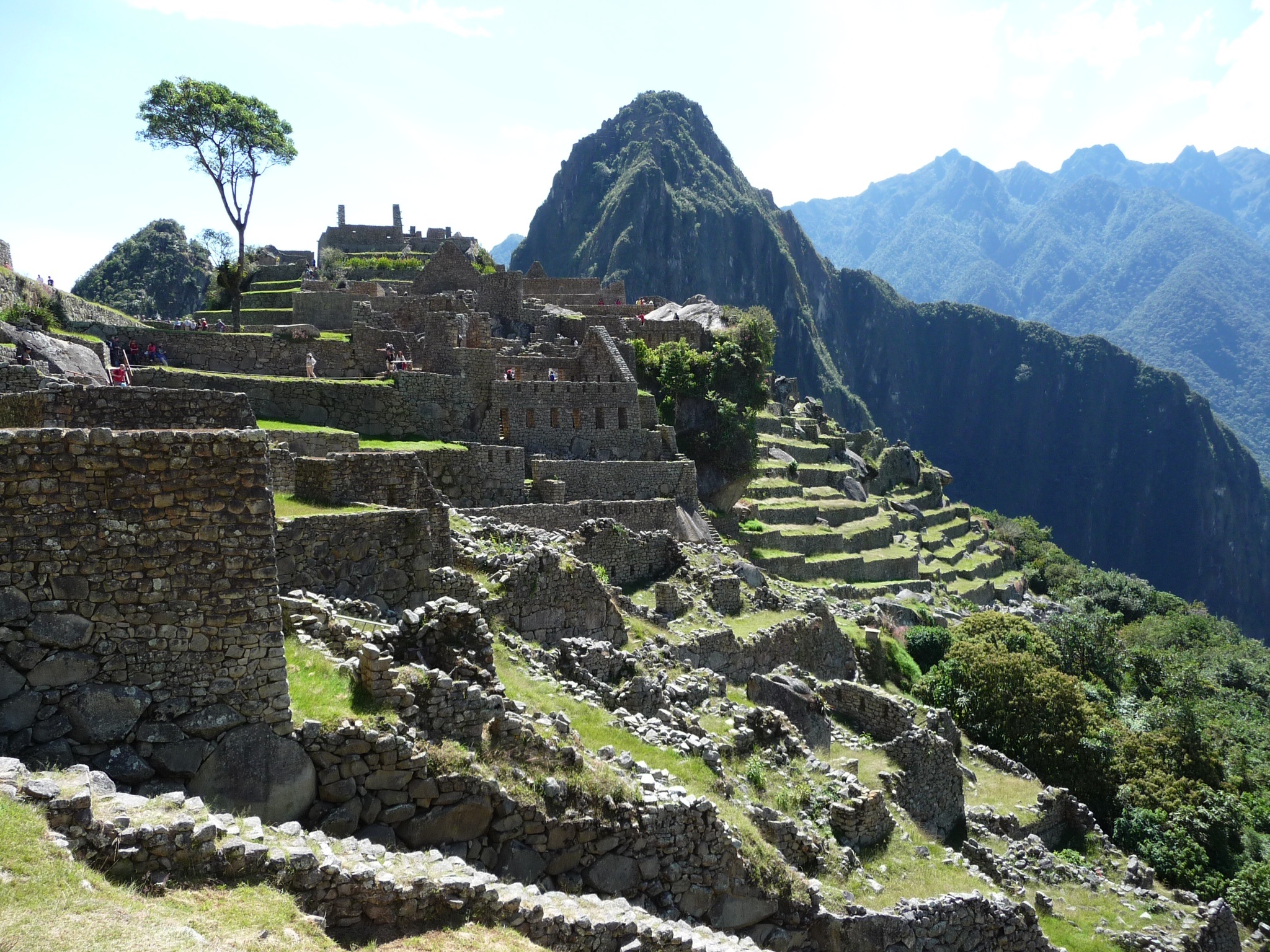
We then made it to the third pass where we got to see Machu Picchu mountain for the first time (the ruins being on the other side out of sight). Then it was 2000 deep steps (that’s fact not exaggeration) downhill causing us all to crab step most of them to avoid ankle injury. Our guide informed us that these were the government built steps – the incas were not such saddists (although I would challenge that given the steps that followed).
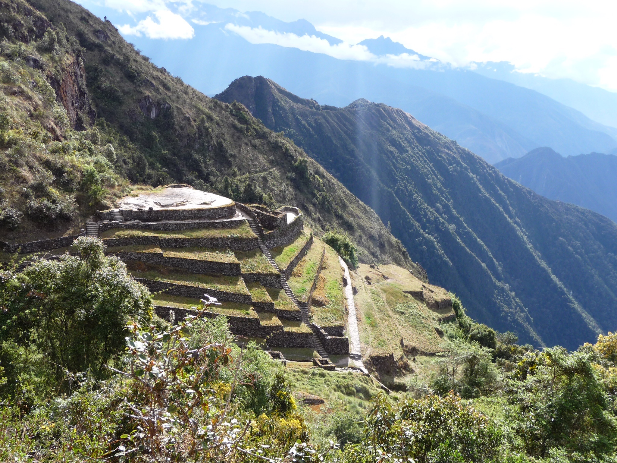
We passed Phuyupatamarka – a town in the clouds – with its six ceremonial fountains, terraces, square, and ceremonial table. It was unfinished due to the arrival of the spaniards.
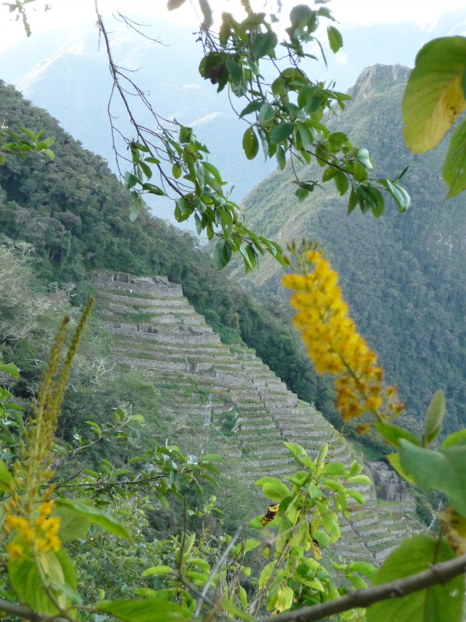
We observed some terraces on the left of Machu Picchu mountain which are believed to have been used as a bit of a laboratory of the incas to create new varieties of fruit and vegetables for the different geological and climatic conditions.
It was about here that my attention started to wane and my verbalised words began to stop matching what my brain intended. Megan and I decided that we could blame such foibles on altitude and hence it became a constant catchphrase for us from then on (whether at altitude or not!).
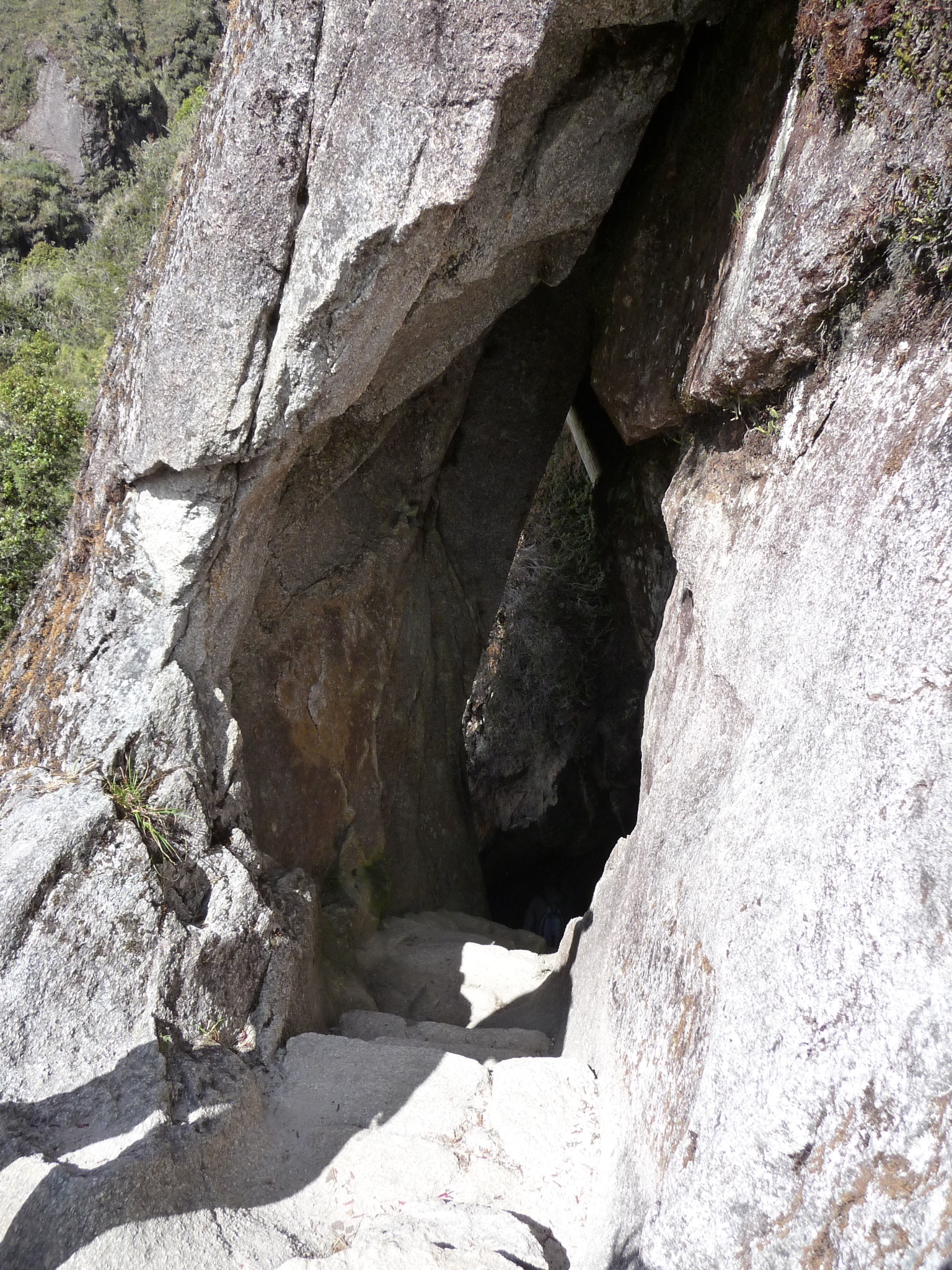
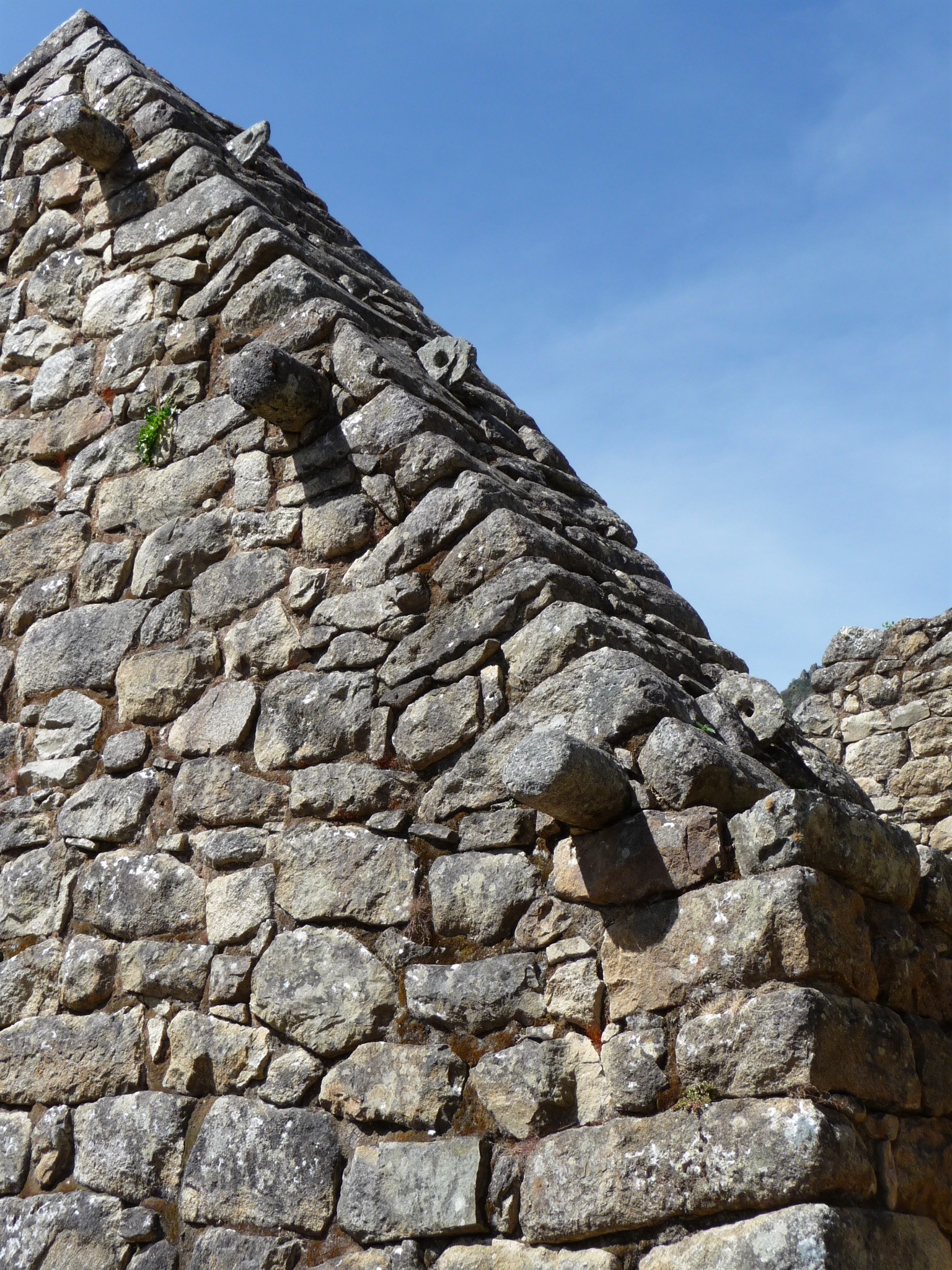
It had been interesting to pass through two Inca Tunnels; it was hard to imagine how the incas had achieved these 20m something tunnels on the side of a mountain with very rudimentary tools – the tunnels even had stairs.
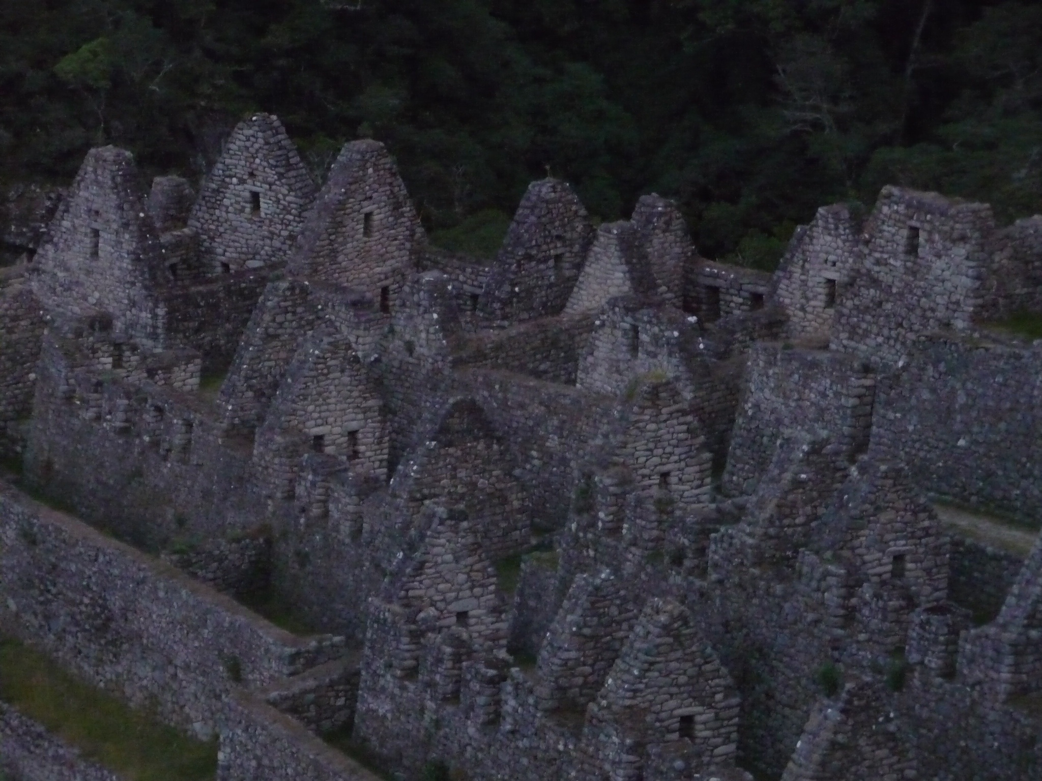
Sophie, Megan and I made it into camp with just enough light to take the short walk across to Winay Wayna. This was a village with 16 ceremonial fountains, a rock as a temple (huaka) and terraces for agriculture – impressive even in the failing light.
Our last night on the trail. I was handed the job of doing the speech of thanks to our wonderful chef and porters. As I handed over the tips I gave each of them a kiss – it was hilarious – despite their shyness all of a sudden they started pushing each other out of the way to go next. The light hair and eyes (and no doubt the single status) had got them! With this confidence in hand they then came around to shake everyone’s hand which developed into a kiss and a hug – something our guide told us he had never seen happen before! It was a touching thank-you to these guys who had gone above and beyond to make us as comfortable as possible in the relatively extreme conditions.
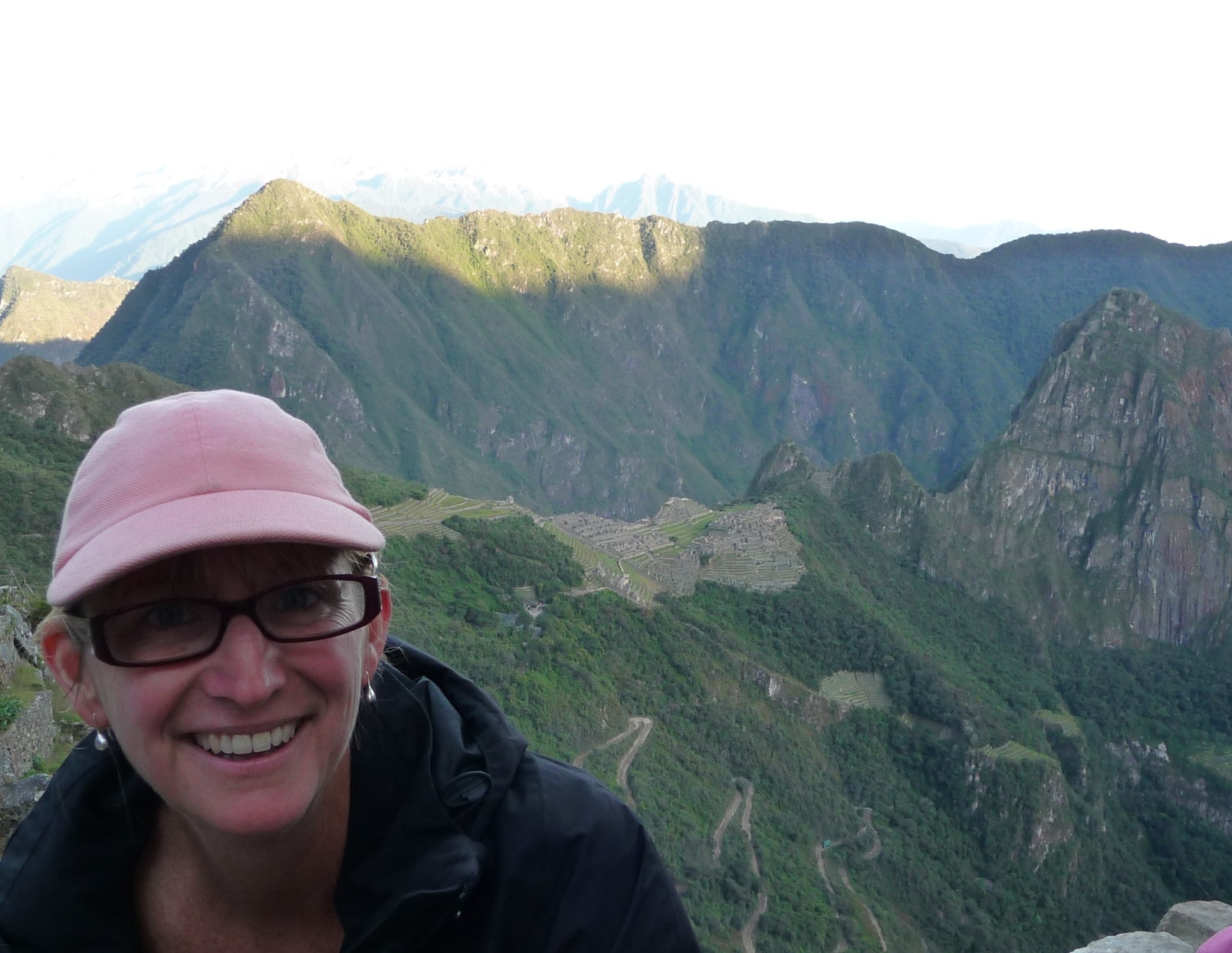
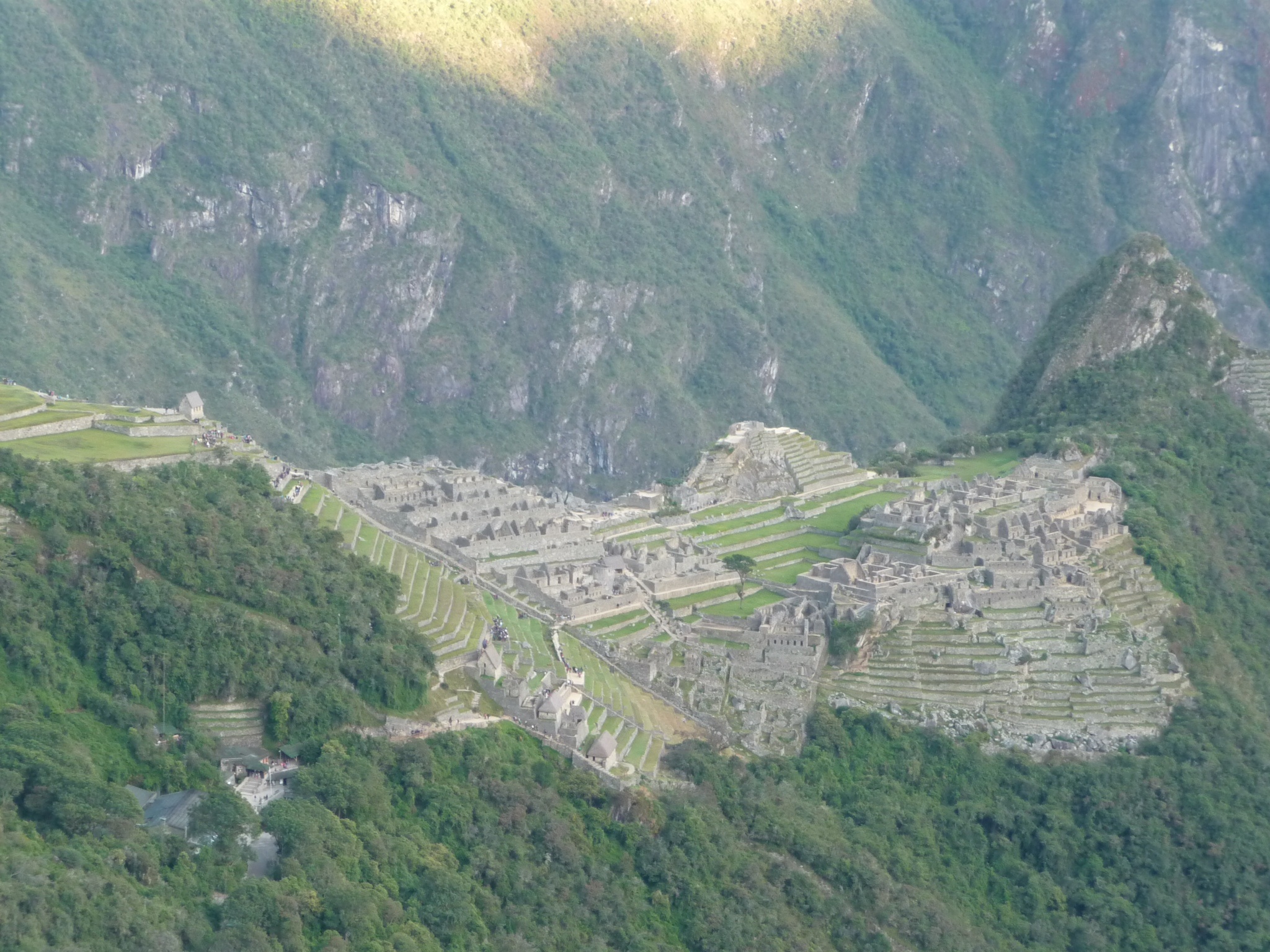
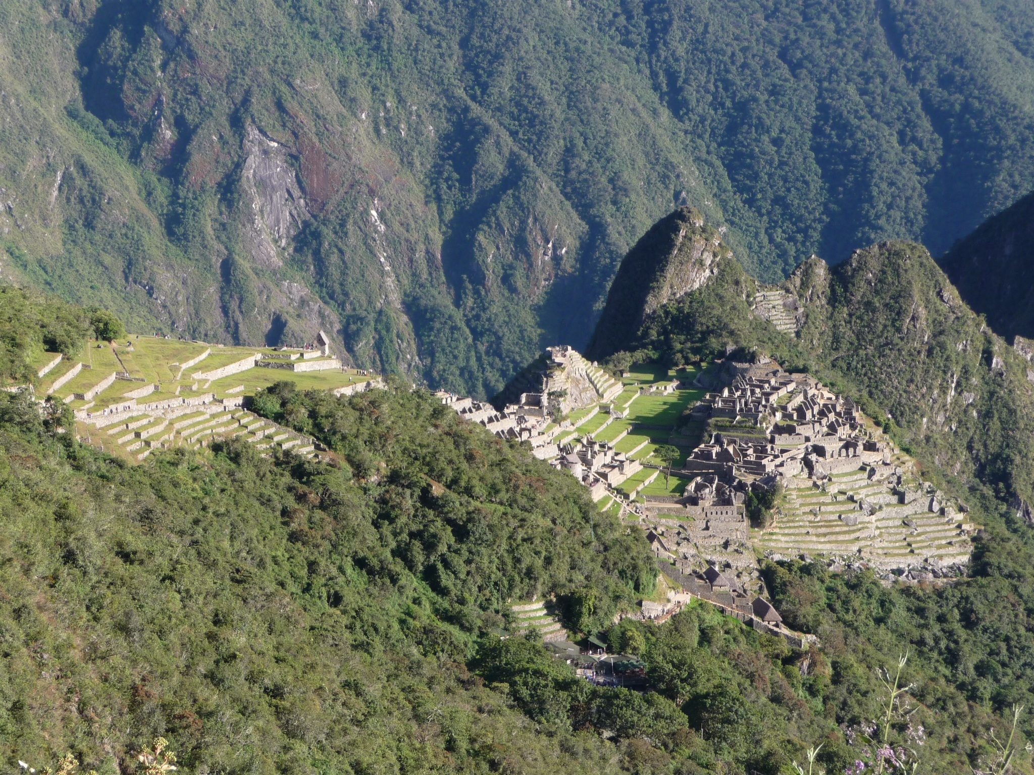
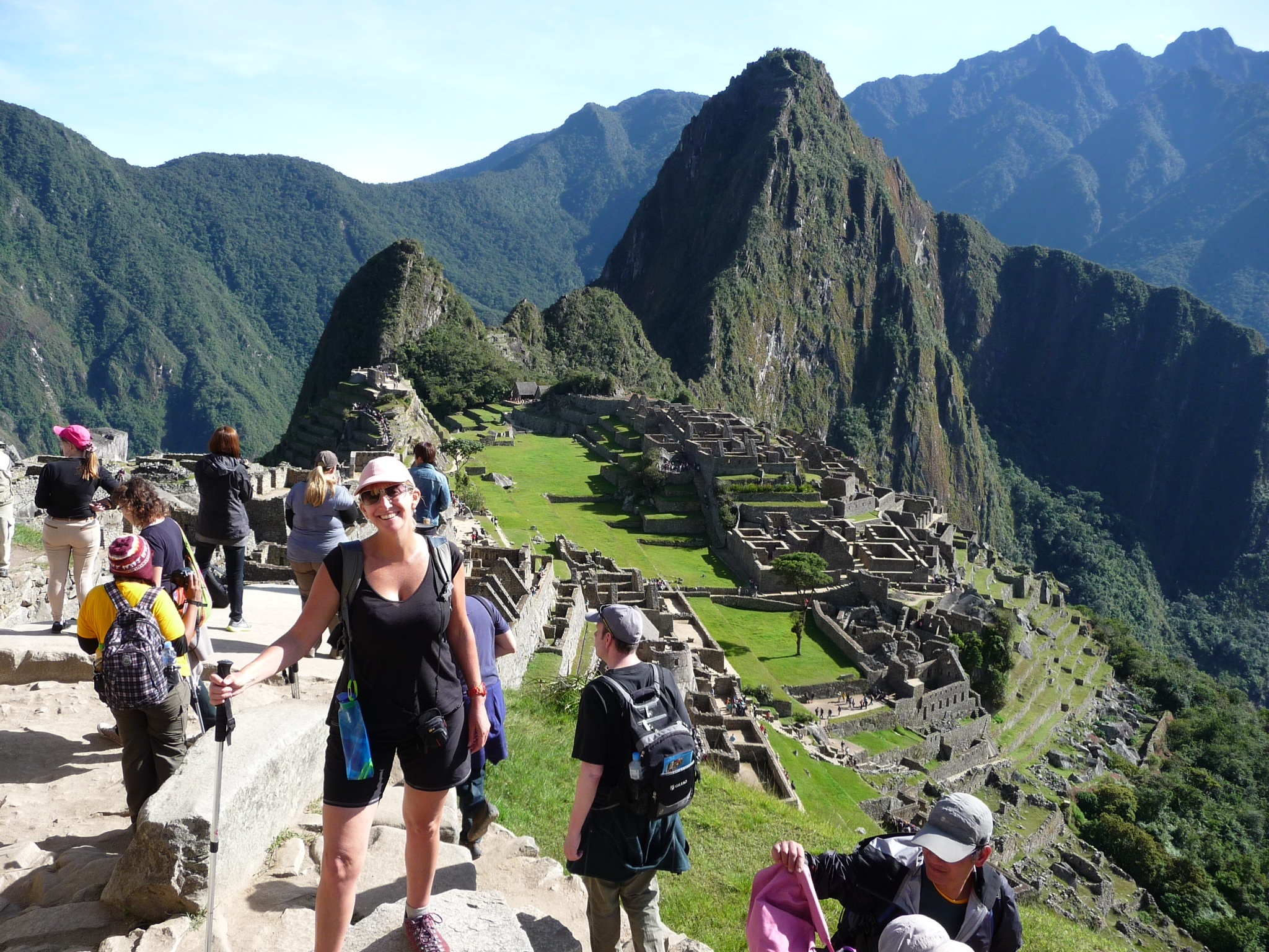
To get to see the sun fall onto Machu Picchu from the Sungate (Intipunku – six kms from our camp) we had to be up at 3:30am (and the famed ‘gringo killer’ stairs were awaiting our arrival). It was a wonderful experience; we had made it – steps up and down, no showers, altitude to 4200m, and calves that ached like I’d never experienced. It was all worth it – the majesty of the mountains, flora, terrain and ruins and a sense of the extremities that you can push your body to when you have a goal in sight. Nothing compared to those crazy 100km runs by Scotty Harrison but certainly one of my life’s biggest achievements – I think it had surpassed crewing on Double or Nothing from Hobart to the Gold Coast.
Once the sun hit Machu Picchu we began to make our way down to the entry.
Machu Picchu and the trails were discovered in 1911 by Hyram Bingham. People were actually living in the city at the time. Hyram’s discovery was by accident as he was actually looking for the lost city of Villcabamba. He too started out in Ollyantambo and later found a farmer who knew of the site and took him there. At the time it was covered in jungle other than where the existing farmers were living. Hyram led a second expedition along the trails which resulted in him finding the ruins we had seen along the Inca Trail.
Picchu means mountain and Machu means old. Winay means young. I was disappointed that I had not been able to get a permit to do the extra hike up to Winay Picchu because it was booked out but contented myself in having got this far.
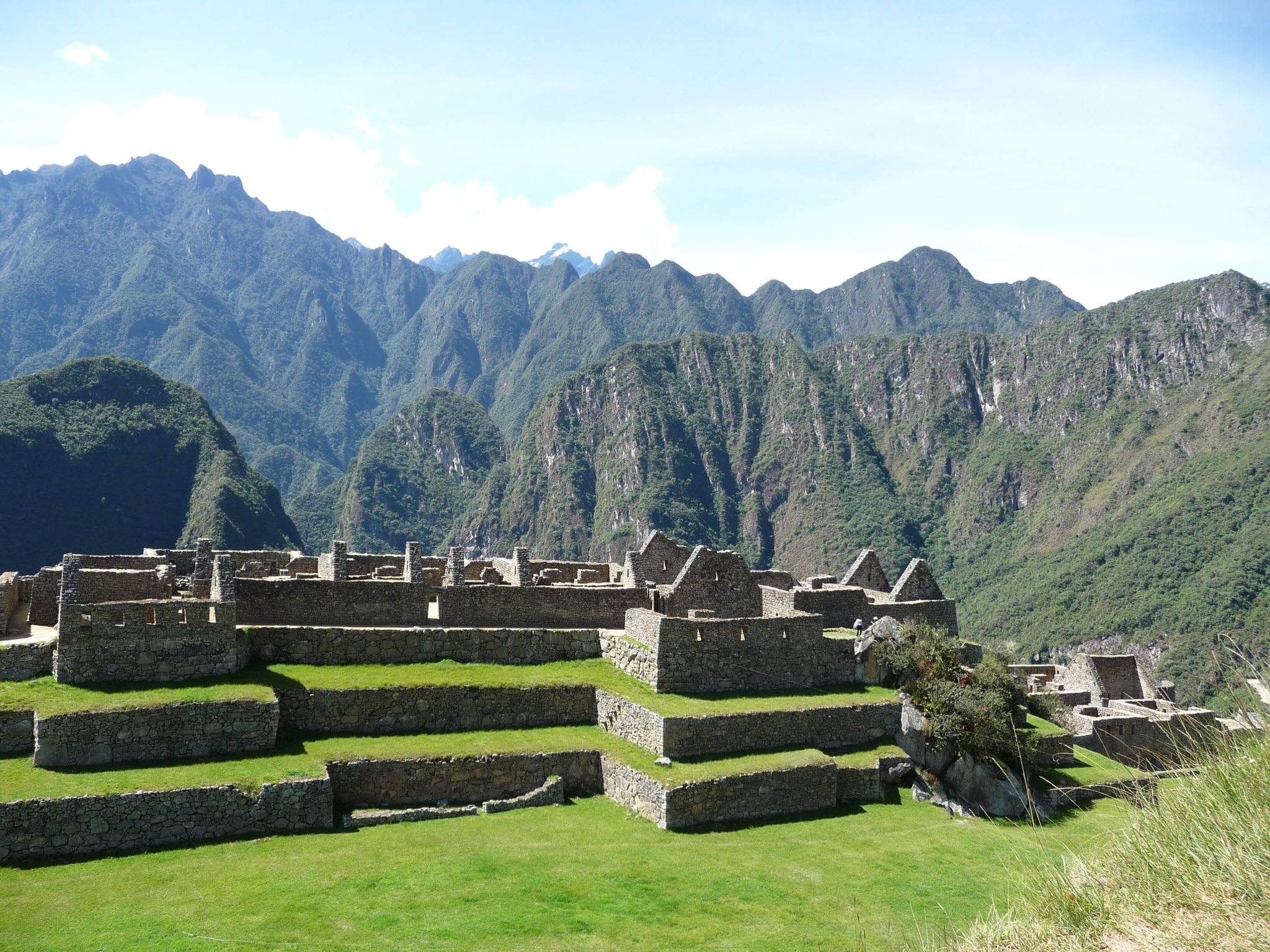
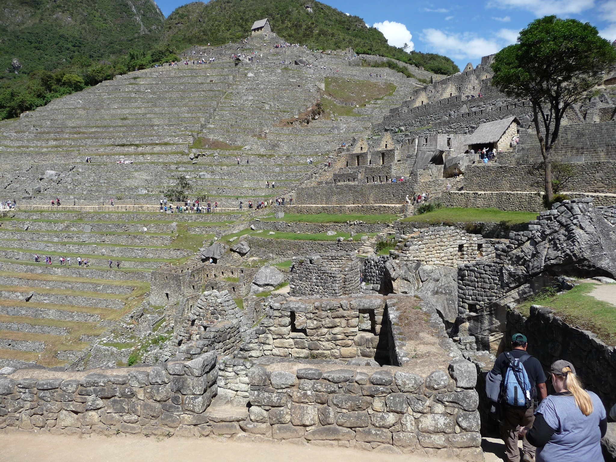
Machu Picchu is located at 2400m – 1000m lower than Cusco and is built on top of the mountain (not the side). It was constructed at the beginning of the 15th century. There was an urban sector (stores/workshops), religious sector and an agricultural sector.
The original theory was that it was only occupied by women as a type of ‘convent’ but later studies showed that the bones relied on for this theory were in fact from males – Andean men being quite small. The latest theory is that it was a multi-functional city but its main purpose was religious. There are temples for each of the gods of nature and the artefacts found at the site were from other areas suggesting people had visited Machu Picchu as pilgrimages (even stones from other areas were found – the incas tended to carry stones to new sites from their homes).
It is still not completely clear why the incas left the site, which was such a naturally good fortress. The usual theories of disease from Europeans have been presented but its not conclusive. The conquistadors didn’t ever find Machu Picchu, believed to be as a combined result of it being often covered by cloud and the last Inca having taken a very different route to Villacamba to protect the whereabouts of Machu Picchu.
The tour around the temples, main square and houses had been really interesting; the four days were now complete!
We headed down to the little town of Aguas Calientes by bus with thoughts of sitting in a spa of thermal springs only to discover that they’re pretty dirty so opted for a celebratory lunch and cold beer instead! We were then onto the train for the trip back to Cusco.
It was hard to believe it was over. All quite emotional really. I had been among the fittest in our group and had had a very good understanding of what we had been seeing given what I’d been reading in my book ‘The Conquest of the Incas’. I think walking the trail may have just eclipsed seeing Machu Picchu but there was no doubt both had been a wonderful once in a lifetime experience.
So, now that Machu Picchu is done, who’s interested in Everest?


In the shadow of Veronica

And I think 5kg is a lot to carry!

No time for the porters to admire the views


Patallaqta Qentimarka

A little fun practicing the art of posing!

Yes I did ask – “how much for one of those”!

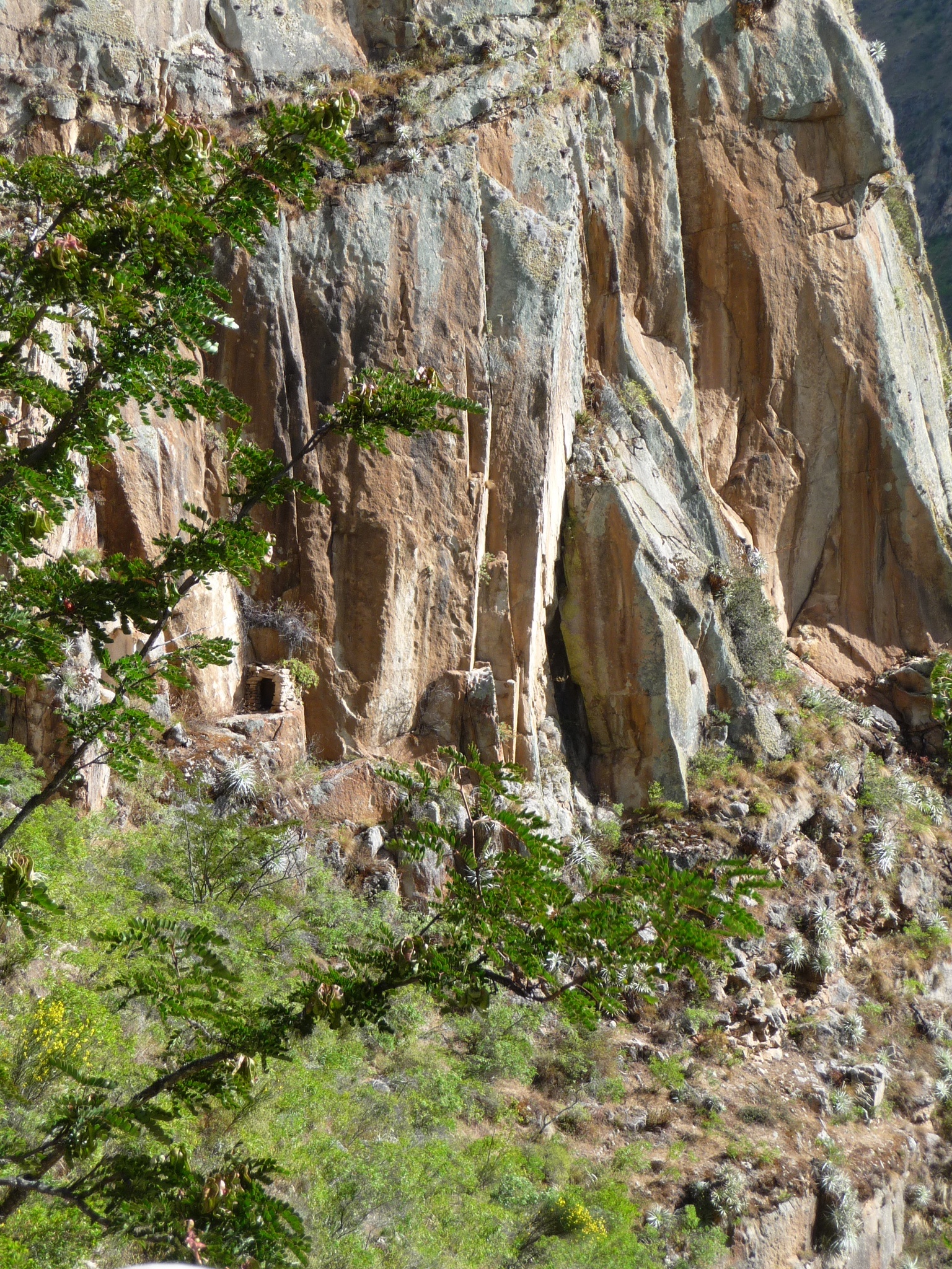
Tombs along the way

Packing up after lunch day one


Ready to go again day two

…and it’s warm again!


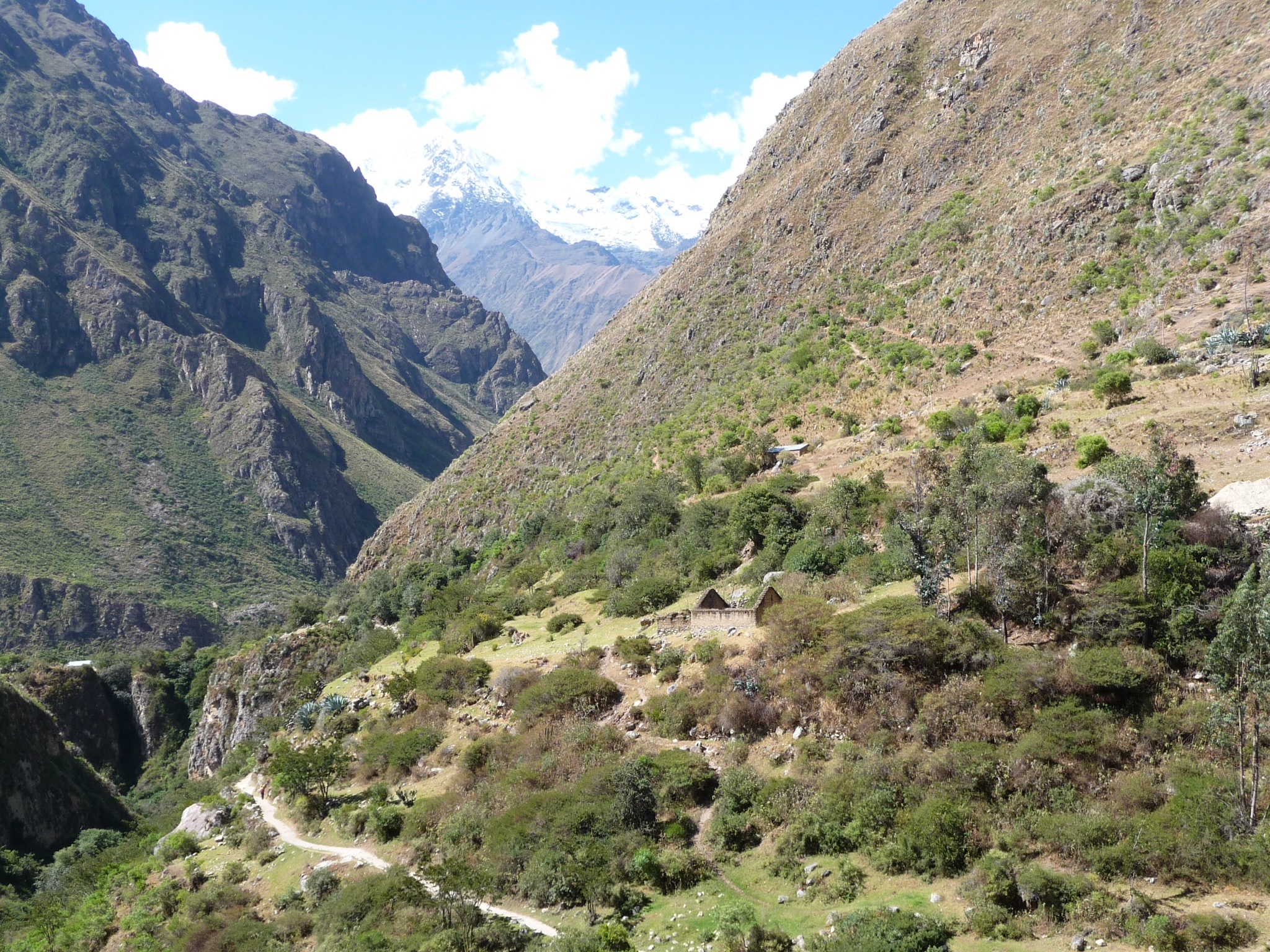
Looking back down on the trail


Lunch time day two


Leaving the lunch spot well behind

Megan sets a cracking pace


Live woman at Dead Woman’s Pass!

…and then down again!

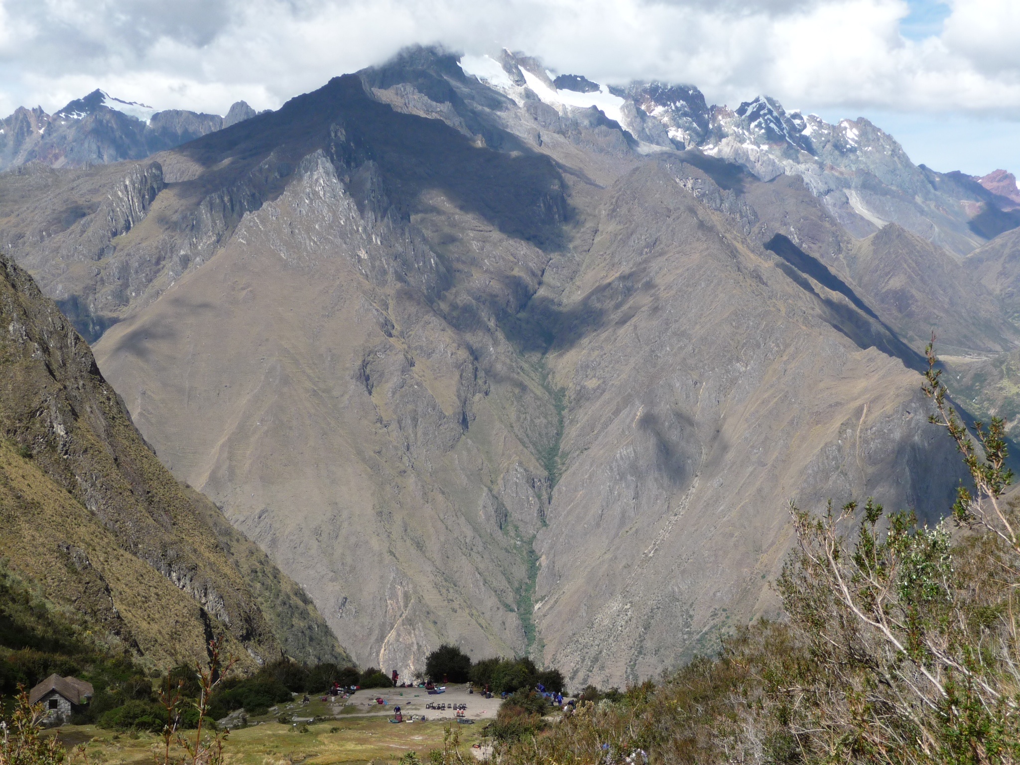
The welcomed sight of the campsite.

Runkuraqay


“I love steps, I love steps, I …”

Sayaqmarka


Qonchamarka

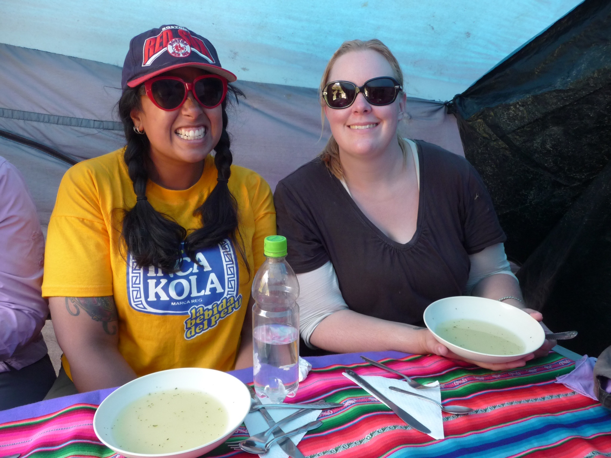
Patrina and Monika enjoying the starter of quinoa soup.


Inca tunnel


Phuyupatamarka


Intipata


Winay Wayna at dusk


The thank you and tipping ceremony

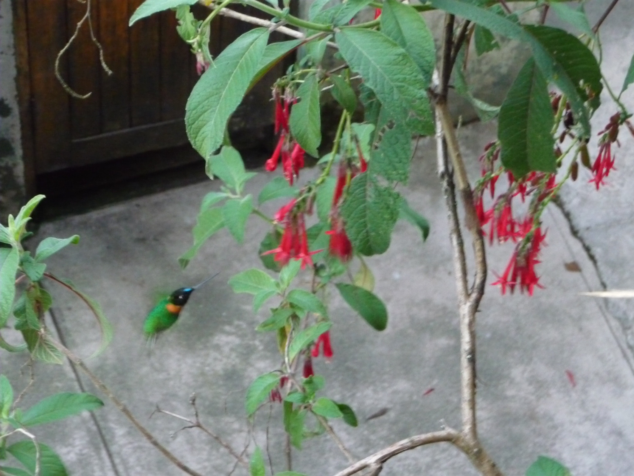
Hummingbird at camp

At the sungate at sunrise overlooking Machu Picchu


Storehouses


Temple of the sun


Still withstanding earthquakes


Amazing Letitia, & if you weren’t fit before you certainly will be now. Love the photos and the blogs. thank you 🙂
Thanks Lynn – I’ve been loving your facebook posts – you guys seem to have been out and it’s good to see the whales have arrived to Korkora Beach! Lx
You are my hero Letitia! Great story. I really felt your pride and awe. I’m in for Everest. 🙂
Hello Teesh, I know I’m a little behind sorry, but that was my favourite read so far. To think we were all worried about you going to South America. Love Maria xx p.s. thank you for the girls’ postcards